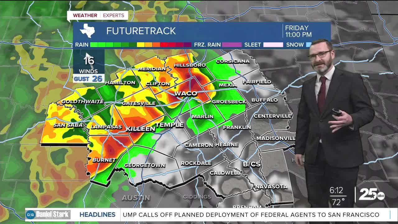


CENTRAL TEXAS — Two rounds of showers and storms are possible this weekend, with the first round arriving tonight. Some will be severe with all hazards possible.
THE BREAKDOWN:
- Two rounds of storms this weekend.
- First round arrives tonight.
- Hail, wind, isolated tornado all possible.
- Total rain of 1-2" likely with some 3-4" possible.
Good morning! We're waking up to a muggy morning as humidity has worked back into Central Texas. A few showers will be possible this morning and today, but by and large the big storm chances will hold off until tonight. Highs will make it into the mid 80s helping to provide fuel for storms tonight.
Storms will initially develop over West Texas later this afternoon before working east into our area after sunset. First under the gun will be our western counties. All hazards will be possible though the main threat will be high winds. If storms can stay separated longer, they could have the potential to spin and produce an isolated tornado. This will be most likely west of I-35. Storms will congeal into a line and move across all of Central Texas into the overnight hours. The best chance along the I-35 corridor will be after 10pm. As they move east across our area, the strongest may still produce gusty winds to 60mph before clearing out by daybreak.
I do think we will see a quiet time during the morning hours Saturday, but as we get warmer in the afternoon, I expect scattered showers and storms to fire up again. These will be capable of heavy rainfall, along with the strongest carrying the potential for coin size hail and 60mph winds. The best likelihood for severe weather will be across the Brazos Valley and activity will clear out during the evening Saturday. Many will see 1-2 inches of rainfall, but those that get storms both days may see some 3-4 inch totals. Great for our drought situation but may cause flooding!
Things dry out Sunday and we are tracking a stronger cold front by Tuesday that will bring highs back into the 70s for a good chunk of next week!
Have a great Friday and stay safe!
Meteorologist Josh Johns
25 Weather
