

CENTRAL TEXAS — A few showers and storms will be possible today, with more activity expected Thursday. A few of these storms may be strong with heavy rainfall and gusty winds.
THE BREAKDOWN:
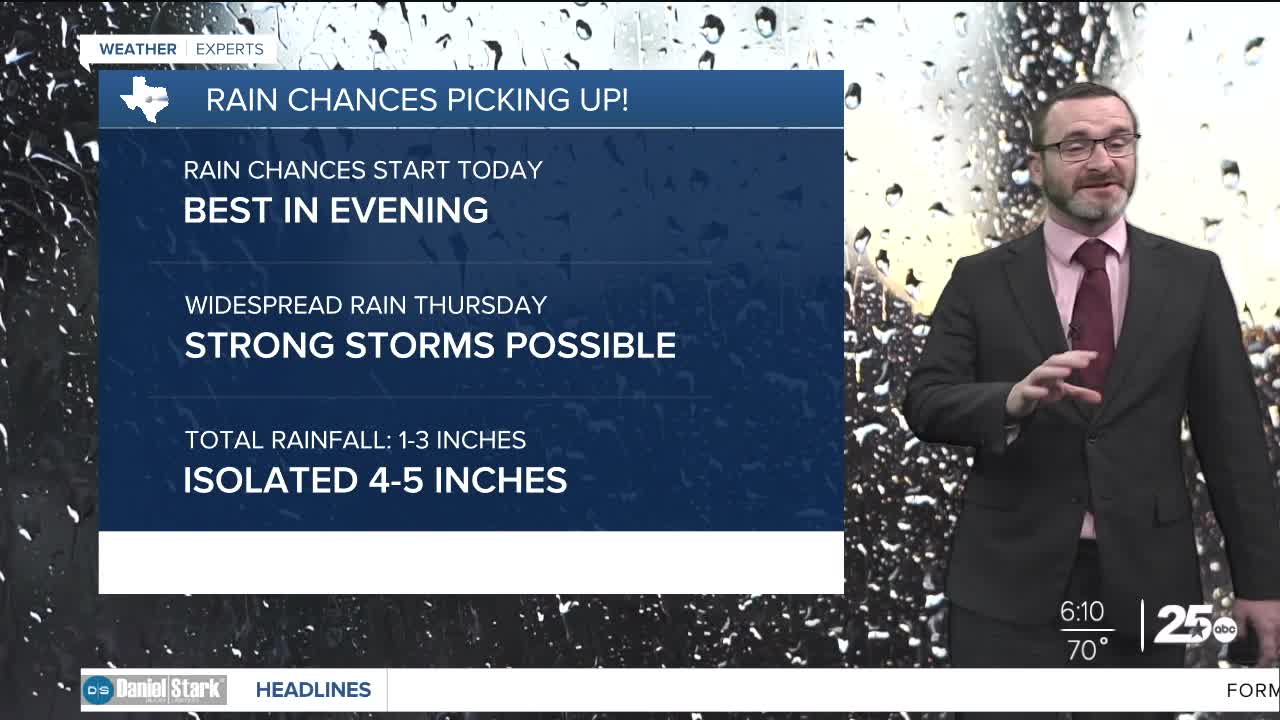
- Rain chances start today.
- A few showers and storms possible this afternoon/evening.
- More shower and storm activity expected Thursday.
- Heavy rain and flooding possible.
- Rainfall through Friday: 1-3 inches with isolated 3-4 inches.
Good morning! We're waking up to the humidity today as our next storm system is starting to ramp up. The first effects of that will be visible today as a few storms will be possible, especially in the second half of the day into the evening. If storms can fire today, potential will be there for some stronger ones. The best chance for that will be along and west of I-35. Highs will get into the low 80s this afternoon.
Showers and storms are expected to be more widespread Thursday with the potential for heavy rainfall and even some strong storms. I expect a few rounds of showers and storms with the potential for a stronger round Thursday afternoon. Heavy rainfall will be possible with these storms, with the potential for flooding. Activity should slowly taper off heading into Friday as drier air works in. Total rainfall of 1-3 inches of rain is expected, but areas that see multiple rounds of storms could pick up 3-4 inches of rainfall. I think the highest chance for that will be over our southwestern counties where a flood watch is in effect.
Drier conditions work in Saturday with quiet and cooler weather expected as highs climb into the low 70s. Another storm system will come into the picture Sunday into Monday with the potential for more widespread storms and heavy rainfall. We'll iron out more details on that system after this one. A stronger cold front is expected to arrive by Turkey day sending highs into the 50s!
Have a great Wednesday!
Meteorologist Josh Johns
25 Weather
