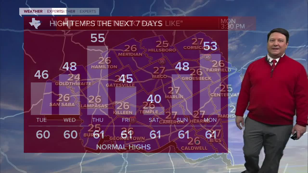


25 EVENING WEATHER — We are not quite out of the woods with the winter storm just yet. Yes, we have seen melting on area roads today, but that should all refreeze tonight. This makes black ice more likely. Black ice is clear ice and harder to see, especially at night. It looks like dry pavement, but it isn't. If you can stay home, that is still the best case scenario until Tuesday afternoon, when highs will warm well above freezing in the mid 40s. That will significantly melt most remaining ice. With that said, there could still be icy patches Wednesday morning with lows in the 20s.
Wednesday afternoon looks nice with highs in the upper 40s under mostly sunny skies. We should see the 50s Thursday, but another cold front will arrive Friday into the weekend.
Our next front now looks to come in dry. That is good news since we have another cold air mass on the way. Highs Friday will be in the mid 40s, but we should drop to near 40° for highs Saturday afternoon. Lows at night this weekend will return to the 20s, but at least it will be dry!
Want this forecast delivered to your inbox each morning? Sign up for the daily forecast email newsletter here.
