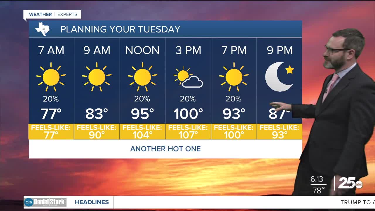


CENTRAL TEXAS — Highs will climb into the upper 90s to near triple digits this afternoon with feel-like numbers exceeding 105 in spots. Some may see an isolated shower or storm, but most miss out.
THE BREAKDOWN:
- Another hot one with highs near 100.
- Isolated storms possible in the afternoon.
- Higher rain chances for the mid-week thanks to a cold front.
Good morning! We're waking up to another humid morning with lows in the upper 70s. A few storms may impact the Brazos Valley during the first part of this morning but the big story will be the heat as highs climb into the upper 90s and triple digits. With the humidity that means it will feel like 105 or hotter, so you need to take those heat precautions: drink plenty of water, limit time outside, and if you do have to be outside in the heat of the day take frequent breaks in the shade.
Things change a bit for the middle of the week thanks to a cold front set to arrive tomorrow. Now ahead of it, we'll still see highs in the upper 90s. However, some storms will be possible with it, which may keep temperatures cooler in the afternoon. This will lead to mid 90s to round out the week with storms still possible Thursday and lesser rain chances heading into Friday. The weekend heats up a bit more and we'll be hot again early next week before a stronger cold front has a chance to impact us. That could send temperatures into the low 90s by the middle of next week!
Have a great Tuesday!
Meteorologist Josh Johns
25 Weather
