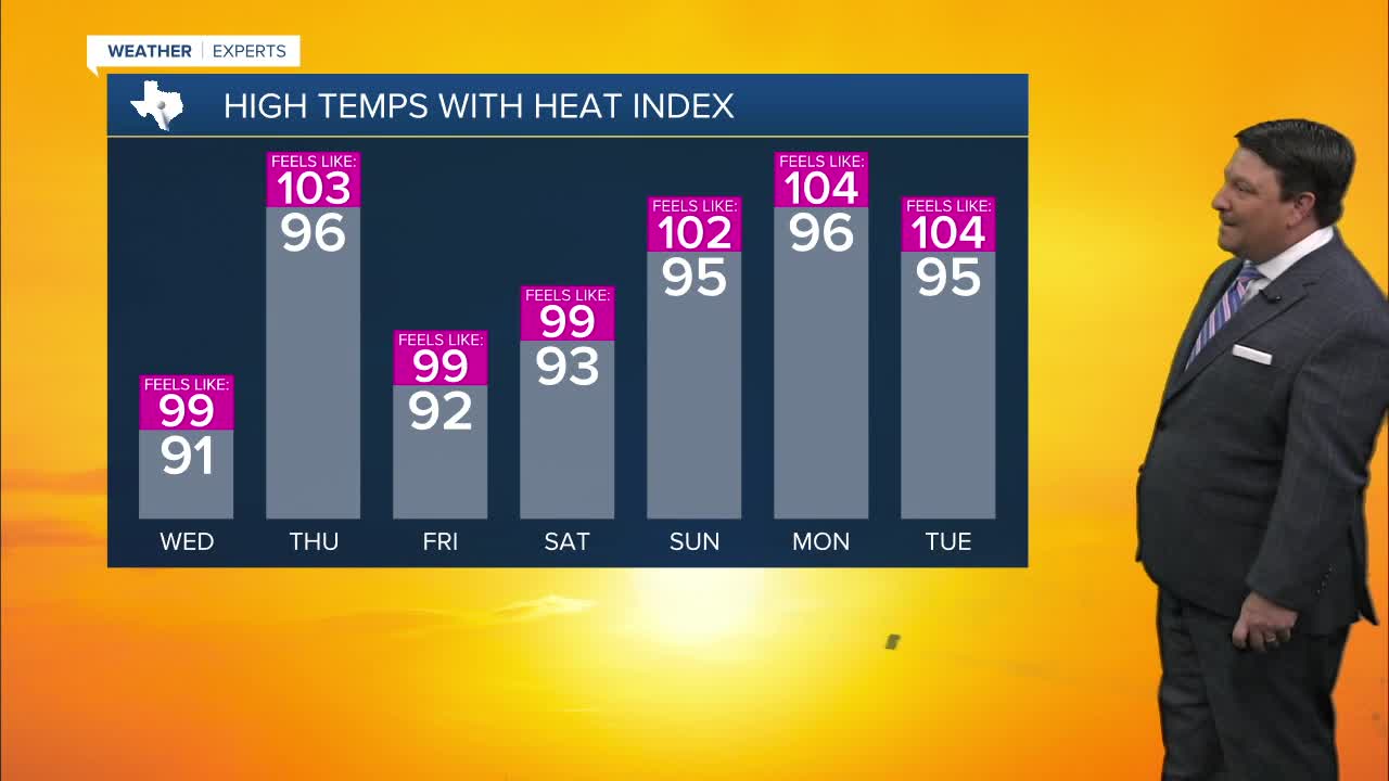


25 EVENING WEATHER — A tropical system is trying to get organized to our south. No matter what happens, the track will likely take rain chances away from our area, so get ready for a little heat and humidity over the next couple of days. Highs will be in the low 90s Wednesday, but we should jump into the mid 90s Thursday. It will feel like it's at or over 100° with the humidity. If you are traveling down toward Houston, you may run into flooding rains, so be careful!
A cold front looks like it will stall to our north Friday into Saturday. Scattered thunderstorms may develop close to our area. Rain chances look lower than previous days, but we will at least keep a 30-40% chance of rain in the forecast as of now. Highs now look like they will make it into the low 90s both days.
Father's Day Sunday just looks hot and humid. highs will be in the mid 90s, but of course it will feel even hotter with the humidity. This hotter and drier trend may continue into most of next week, so summer is going to try to take hold!
Want this forecast delivered to your inbox each morning? Sign up for the daily forecast email newsletter here.
