

25 EVENING WEATHER — It's officially fall, but it doesn't feel like it yet. We will stay on the hot side of things through Tuesday. Tonight looks mostly clear with lows in the mid 70s. Tuesday afternoon, a cold front will remain north of the area. This will allow highs to climb into the mid 90s across most of Central Texas. The front will initiate showers and storms, but those will not get into the area until late Tuesday night.
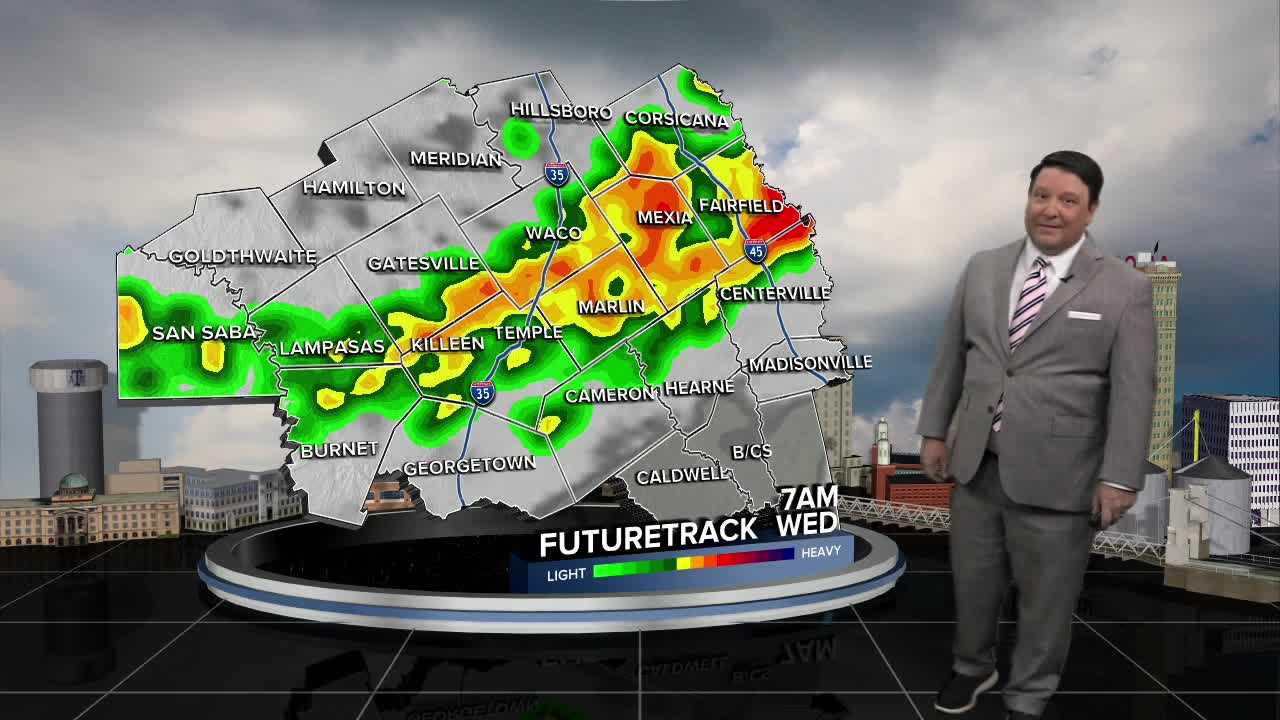
The cold front mentioned above will roll across Central Texas Wednesday morning. Scattered showers and storms are expected on and off throughout the day. This will cause highs to drop into the 80s, but some areas in the Brazos Valley may climb close to 90° since the front will arrive there last. Either way, we start cooling things down a bit around here.
Rain chances will slip south Thursday through the weekend. Temperatures are expected to be a bit nicer in the mid 80s Thursday, upper 80s Friday, and back close to 90° Saturday and Sunday. The really nice part...lows should fall into the 60s each morning!
