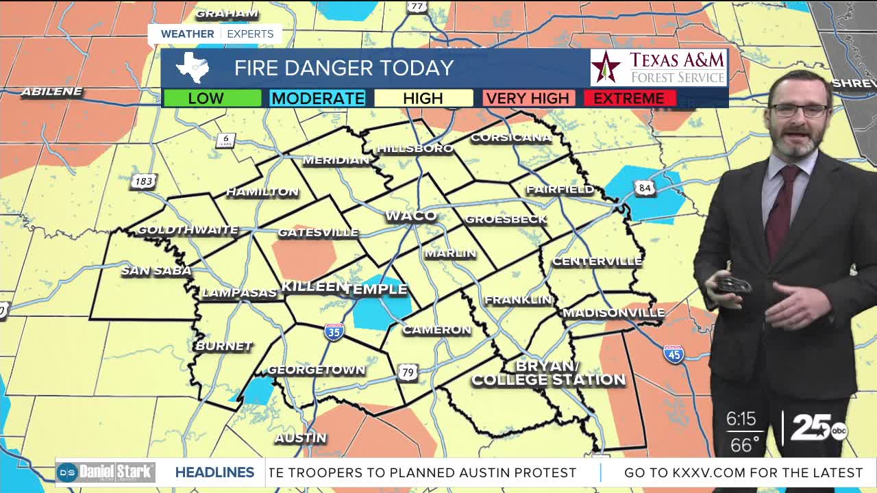


CENTRAL TEXAS — Highs will climb in the low 90s thanks to the south winds turning gusty again. That combined with drier air will lead to a high fire danger.
THE BREAKDOWN:
- High fire danger today thanks to highs in the 90s and gusty winds.
- Cold front arrives tomorrow, but does not clear fire danger.
- Decent storm chances arrive this weekend.
- Stronger cold front possible next week.
Good morning! You may not be able to tell when the sun comes up, but Monday started in the upper 40s in Waco. South winds up to 20mph have brought warmer air in the area though, already pushing temperatures back into the 60s before the sun has risen. Expect the south winds to continue to bring in warmer air today as it will push highs into the low 90s. That wind combined with dry air will lead to a high fire danger across the entire area. Don't do anything that could cause extra sparks, as winds will easily fan fires that could form.
A cold front arrives tomorrow, but won't clear the fire danger. Highs will still be in the mid 80s with sunny skies. Dry air will keep the higher fire danger around the entire area again. Winds turn southeast Wednesday and Thursday which will bring back a little humidity. Highs will be in the 80s for the middle of the week, increasing into Friday as a stronger upper-level storm system passes to our north. That should lead to decent rain chances Friday into Saturday. I'm not going to say it's a guarantee, but it's the best signal I've seen in a while. Some storms could be strong, with the best chances overnight into Saturday morning. We'll stay warm for the weekend with highs in the 80s, nearing 90s on Sunday. A stronger cold front looks to arrive by the middle of next week that could bring highs in the 60s! Stay tuned!
Have a great Monday!
Meteorologist Josh Johns
25 Weather
