

CENTRAL TEXAS — A cold front will bring drier air for Tuesday, keeping the fire danger high as we climb into the mid 80s. Rain chances are increasing for the end of the week.
THE BREAKDOWN:
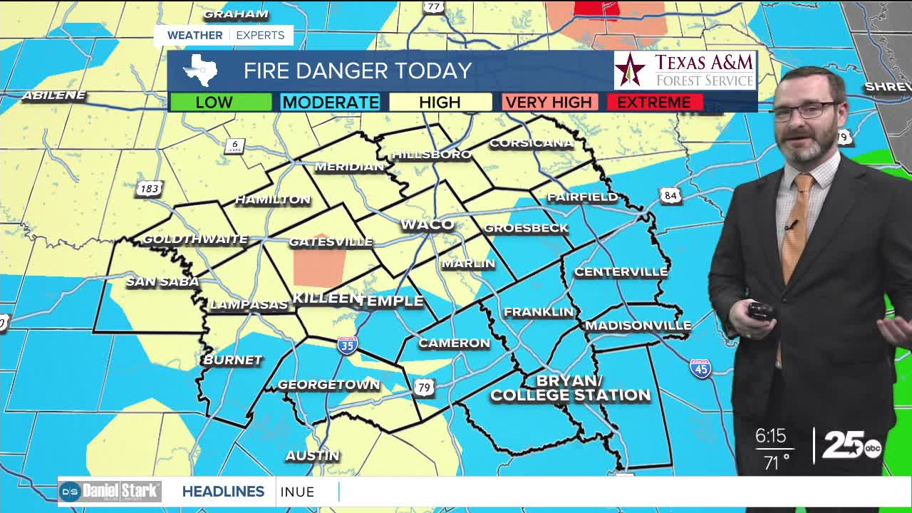
- High fire danger again today.
- Highs will climb into the mid 80s this afternoon.
- Rain chances increasing for the end of the week.
Good morning! We're waking up to a bit of a muggy start ahead of a cold front. This front will bring in drier air taking dew points down into the 30s and the 40s. While that will feel nice to us, combining with temperatures in the mid 80s, it will be a recipe for fire danger to stay high in Central Texas. The dry air and winds around 15-25mph will fan any flames that can fire up so continue to take fire weather precautions.
Drier air will lead to a chilly morning as lows fall into the upper 40s and lower 50s. Dry air will allow us to warm quickly tomorrow as well pushing us back into the mid 80s. South winds kick up for the second half of the week pushing temperatures back into the upper 80s. That will help load our atmosphere with moisture in time for our next storm system. A strong upper low will move over Oklahoma this weekend leading to favorable conditions for storms to fire. I do expect showers to start Friday with a round of showers and storms likely Friday night into the first half of the day on Saturday. There is the potential for areas to pick up 1-2 inches of rainfall if everything pans out the way it's projected. Let's hope for it because that would really help our dry conditions!
We'll see a brief cool-down Saturday into Sunday taking highs into the upper 70s and low 80s before our next front arrives Monday into Tuesday and this one will bring a decent cool-down! We may see highs in the low to mid 70s for next week, including more seasonable weather for Halloween! Stay tuned!
Have a great Tuesday!
Meteorologist Josh Johns
25 Weather
