

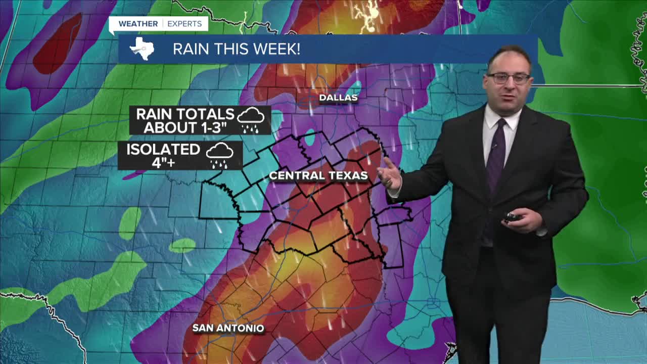


CENTRAL TEXAS — As we get closer to October, we get one day closer to what should be a massive change in the weather pattern for Central Texas. Heavy rain with an incoming west coast storms will also drop temperatures into the 80s at least!
For now, temperatures remain in the mid-90s to start the week with a few random and isolated pop-up storms Monday afternoon. Tuesday is mid-90s and dry.
The set up for later in the week: A large trough in the jet stream just off the U.S. Pacific coast will dig into the southwestern states and cross the Rocky Mountains. It's strong and deep enough that it should extend plenty far south, clear through Central Texas by the end of the week. Additionally, Hurricane Polo in the Pacific will make it's northerly trek across the mountains of Mexico and into west Texas and New Mexico. While the hurricane itself will break apart, it'll add some extra moisture as it links up with the forming cold front around Wednesday, September 30 for parts of Texas.
The cold front will pass through Central Texas between Wednesday evening, Thursday, and linger into Friday. Thursday is the expected day with the most rain and greatest weather impacts. the exact amount of rain is still unclear. Broadly speaking, about 1-3" of rain is likely to fall. There's a chance for higher totals of 4+ inches. Model maximums are up to 7", but that's the very very high-end predictions. This much rain is extremely beneficial for our drought stricken area. We want and need the rain. We'll stay cautious for those 3+ or 4+ inch totals cause that's when the flooding issues come into play, but the dry ground should suck up the rain easily.
Severe weather doesn't appear to be a significant factor in this storm. An embedded thunderstorm or two could create strong winds up to 60mph, but the risk is low.
Temperatures will drop into the mid-80s by Thursday and Friday. About time! That would be the coolest day since June 19th in Waco.
- 25 News Meteorologist Thomas Patrick
Want this forecast delivered to your inbox each morning? Sign up for the daily forecast email newsletter here.
