


CENTRAL TEXAS — The dynamic weather pattern across the southern plains keeps us on our toes as heavy rain now tops weather headlines for Central Texas. Pacific moisture is crossing the South Western U.S. and northern Mexico and will result in scattered showers today, heavy rain Friday.
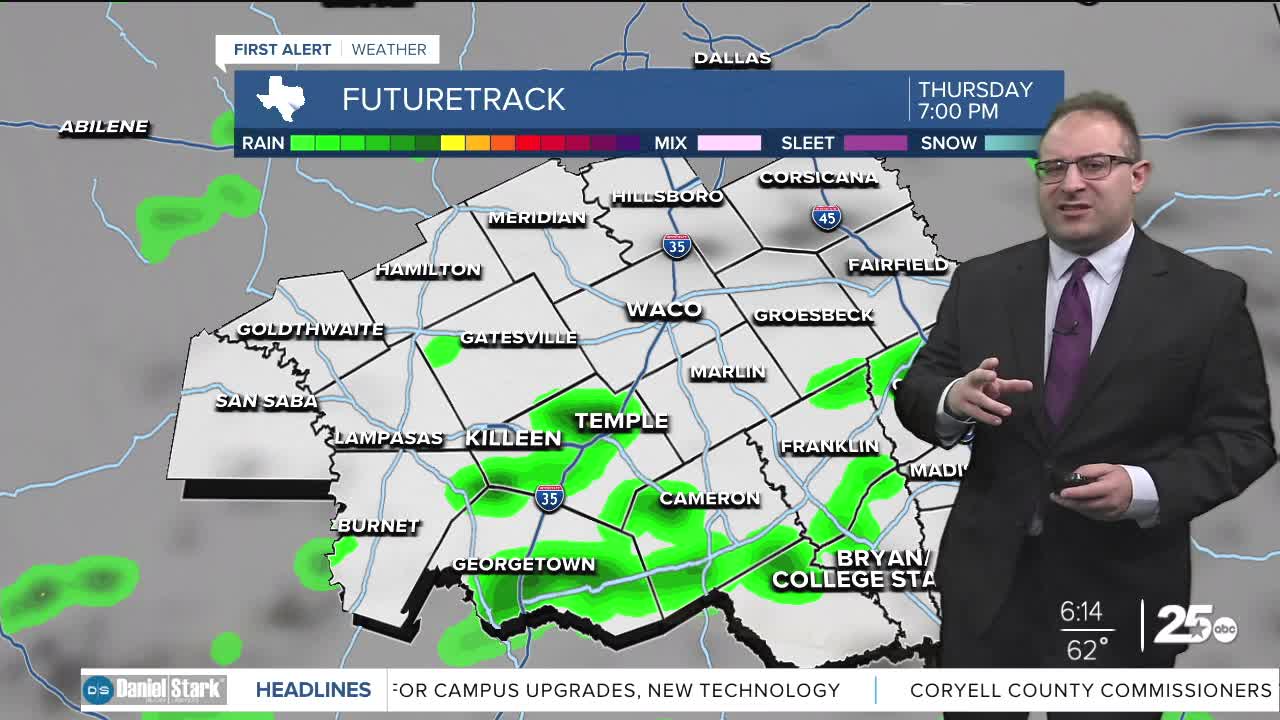
Today, on-and-off scattered showers are likely for the region. I believe most models are over-estimating the amount of convection (thunderstorms) for Thursday since skies will stay cloudy and temperatures cool so there's a limited amount of energy to use for thunderstorms in the first place. Nonetheless, a few rumbles of thunder and a few burst of heavier rain will pop up throughout the day. Our in-house model (GRAF) has the heaviest rain before noon, and light showers in the afternoon.
The bulk of our forecast rain will come Friday. A upper air low pressure will cross the Baja California and move straight over central and north Texas on Friday, bringing all of it's Pacific moisture with it. To be honest, it almost looks like an Atmospheric River that the west coast often gets, ejecting through our region in one decisive 24-hour burst of heavy rain. Rain begins around 4am to 8am Friday and moderate of heavy rain will latest all day long. Rain totals will be on the order of 1.5 to 3.0 inches. Some flooding is possible, no Flood Watches have been issued just yet. Due to the all-day rain, high temperatures will just hang in the upper 50s which will break the record "lowest high" of May 1st which is 62 degrees.
The weekend quickly dries out and offers picture perfect Spring weather! Highs will be in the low 70s on Saturday and mid 70s on Sunday. The ground and grass will probably still be wet as a result of Friday's rain, but the weekend itself features mostly sunny skies and low humidity both days! Enjoy!
- 25 News Meteorologist Thomas Patrick
Want this forecast delivered to your inbox each morning? Sign up for the daily forecast email newsletter here.
