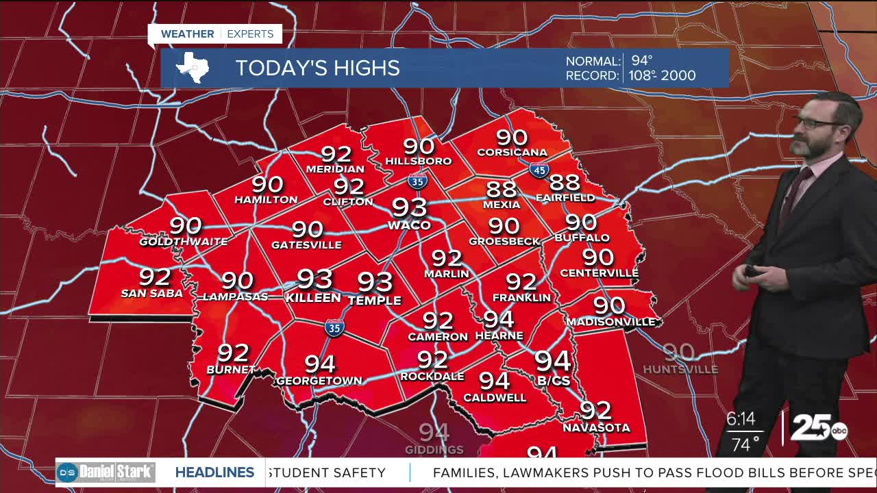


CENTRAL TEXAS — Highs will climb into the low 90s today with temperatures nearing 100 to end the week. Widespread rain chances will move in this weekend.
THE BREAKDOWN:
- Highs climb to the low to mid 90s this afternoon.
- Temperatures near 100 Thursday and Friday with quiet weather in place.
- Rain chances ramp up this weekend, particularly Sunday.
Good morning! We're waking up to a quiet morning with lows in the 70s. Expect quiet conditions to remain in place today as light northerly winds hang around. We'll see highs climb into the low to mid 90s under mainly sunny skies. By morning, with drier air in place, we'll see lows in the 60s.
Thursday and Friday will feature a return to summer-like conditions as southwest winds heat up the area Thursday pushing temperatures closer to 100. More of the same is expected Friday though high clouds will be on the increase.
Rain chances will return this weekend as tropical moisture works in from the pacific. Activity will start off isolated to scattered starting Saturday but should ramp up Sunday and Monday as more widespread showers and storms will be possible. This may lead to heavy rain in spots with many areas picking up 1-2 inches of rain with higher amounts possible west of I-35. Activity will taper Tuesday. With the extra rain chances, we will see highs in the low 80s Sunday and Monday. Once the rain moves out, expect highs back in the 90s.
Have a great Wednesday!
Meteorologist Josh Johns
25 Weather
