

25 EVENING WEATHER — Th calendar has flipped to September, but that doesn't mean much around here. We will see a couple of showers and storms here and there this evening. Any rain activity should die out after sunset with lows in the upper 60s and low 70s. North winds at 5-15 mph will stick around over the next couple of days. You would think that would mean cooler temperatures...right? Nope. We will actually see highs rise into the low 90s Tuesday and mid 90s Wednesday. The air mass will not be as humid, so that part will make it feel a bit more comfortable outside. You will especially notice this during the morning and evening hours.
The heat will continue to build Thursday and Friday. We should make it into the upper 90s both days with south and southwest winds expected. A cold front will likely hold to our north, so we may not see any relief until the weekend.
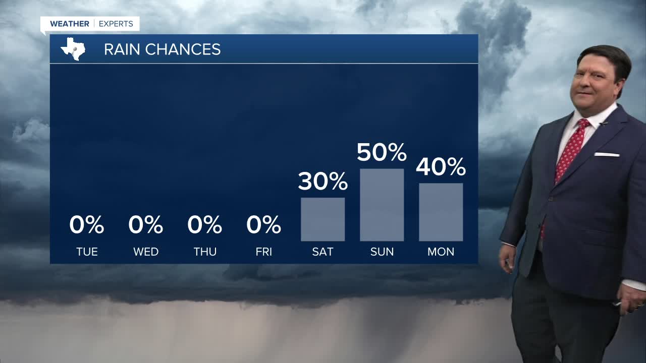
A disturbance will approach as we head into late Saturday and Sunday. This will bring scattered storm chances back to the area along with some cooler temperatures. The best chance of rain will likely be late Saturday into Sunday. Highs will fall from the mid 90s Saturday into the mid 80s Sunday if current model trends hold. Stay tuned...
