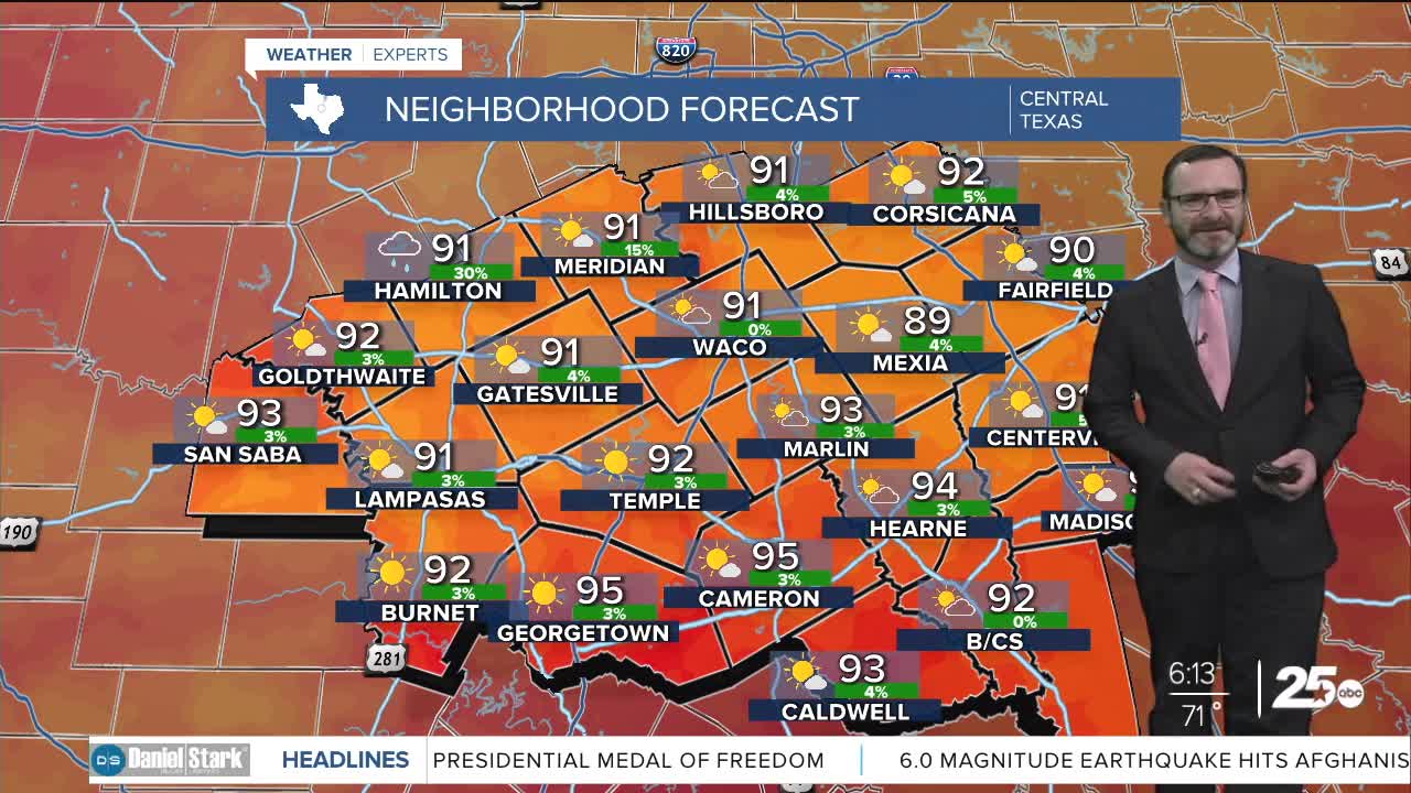


CENTRAL TEXAS — Expect partly cloudy skies today with highs in the low 90s. Rain chances will remain low, but are expected to increase into this weekend.
THE BREAKDOWN:
- Turning toasty again today with highs in the low 90s.
- Rain chances much lower.
- Highs climb into the upper 90s to end the week.
- Rain chances ramp up this weekend with multiple inches possible.
Good morning! We're actually waking up to cooler temperatures today thanks to slightly drier air- at least, in one way. The moisture content overall is lower, but with lower temperatures, that is keeping the relative humidity high. As a result, there will be some patchy fog in spots on your morning commute. That should fade a few hours after sunrise as things get more stirred up. That will also keep things feeling warmer this afternoon as temperatures climb into the low 90s, but feel like the mid to upper 90s thanks to the humidity.
Today is the start of a warming trend that will take us into the upper 90s as we end the week. Friday night football will be much warmer than last week as we expect highs to get closer to 100.
The pattern changes this weekend as a strong disturbance swings over from Mexico. That will lead to shower and storm chances for the weekend, with Sunday potentially setting up to be a wetter day. Potential is there for 1-2 inches of rainfall with locally heavier amounts. With the rain chances around, that will keep temperatures cooler in the mid 80s. There's still disagreement on exactly where the heaviest rain will set up. Stay tuned!
Have a great Tuesday!
Meteorologist Josh Johns
25 Weather
