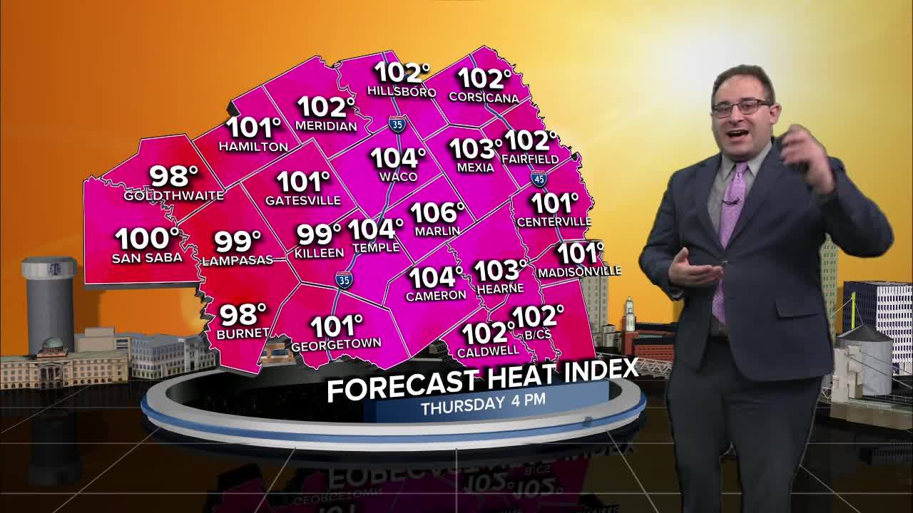


CENTRAL TEXAS — Sweltering heat continues to stick around Central Texas today. High temperatures in the mid 90s, heat index above 100 degrees. Sounds familiar, and that'll continue being the forecast through at least Saturday. With the heat index, or feels like temperature, forecast around 105° for Thursday, Friday, and Saturday there may be Heat Advisories issued by the National Weather Service.
As for rain and thunderstorms, a spotty shower still can't be completely ruled out, especially for the Brazos Valley as the sea breeze off of the Gulf keeps pouring more moisture and activating a few convective showers between Houston and College Station. For the most part, this will be very few and far between, but I'll keep a 20% chance for rain for the Brazos Valley through Sunday to account for this action.
Next week, Central Texas will see a cold front / storm system pass through between Sunday evening and Tuesday morning. This will mark mainly widespread rain and storms for the region and a risk for very heavy rainfall. There's a "Slight Risk" for excessive rainfall on Sunday... but this mainly accounts for the storms in Kansas, Oklahoma, and northern Texas and only just arrive very-very late at night for the Waco area. I believe our main risk for flooding will be on Monday when the cold front properly passes through. Using recent flooding examples, when over 3" of rain falls in a single thunderstorm, we start to see flooding issued in flood prone areas and downstream rivers and creeks.
- 25 News Meteorologist Thomas Patrick
Want this forecast delivered to your inbox each morning? Sign up for the daily forecast email newsletter here.
