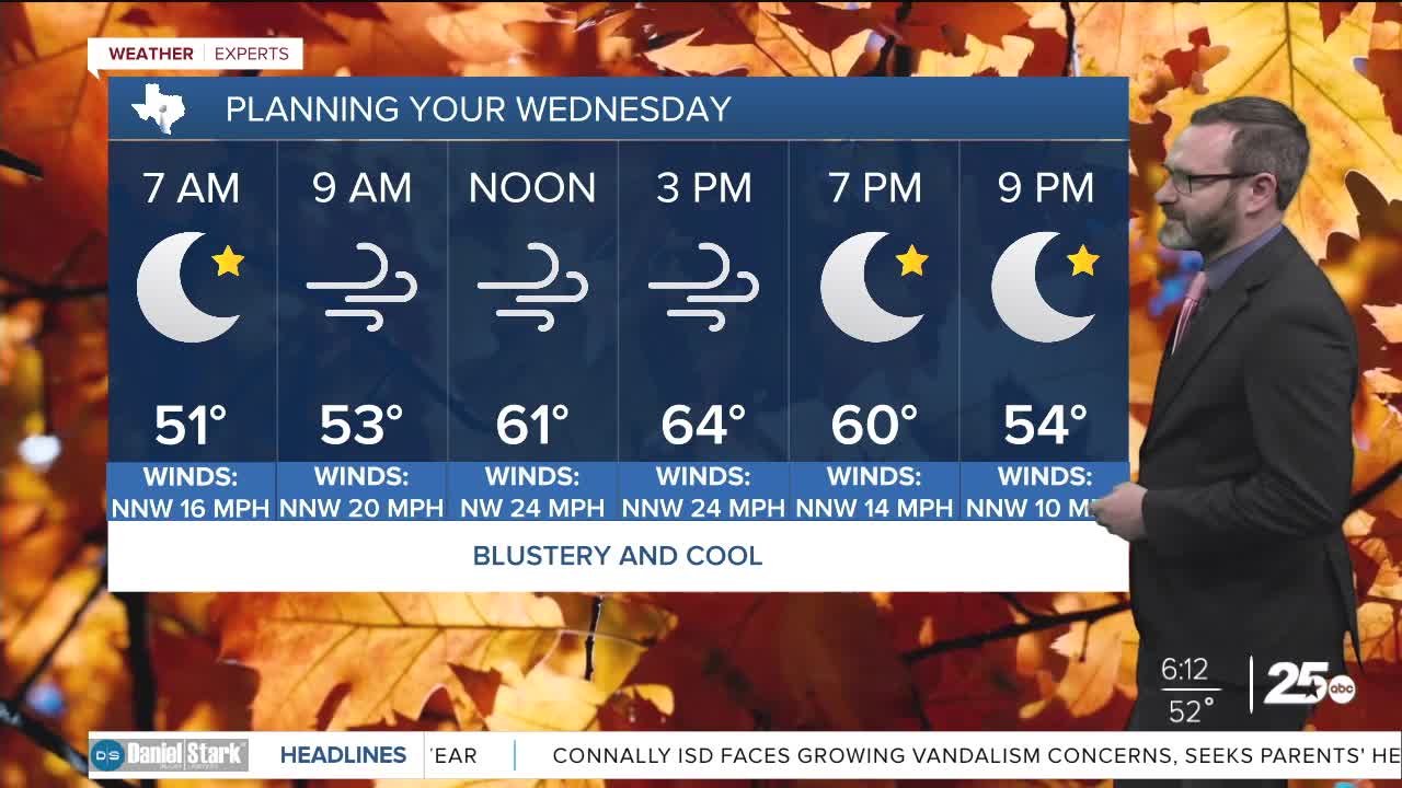


CENTRAL TEXAS — Winds will continue to gust to 30-40mph today as cooler temperatures hang around. Highs will stay in the 60s this afternoon.
THE BREAKDOWN:
- Staying blustery today with wind gusts 30-40mph.
- With the higher wind brings higher fire danger.
- Highs climb into the mid 60s.
- 30s and 40s possible overnight.
Good morning! The winds of change certainly blew in yesterday thanks to our strong cold front. As winds gusted 30-40mph, we saw cooler temperatures work in. This morning that's leading to 40s and 50s, so you'll want to grab the jacket! Plan on a jacket or sweater through the day as highs will only get into the mid 60s this afternoon. Gusts could once again reach 30-40mph. As winds relax overnight, we'll see the coldest temperatures set up as we will likely wake up in the 30s and 40s by morning.
Expect a chilly start to Halloween as well, but we'll set up nicely in time for trick-or-treating with highs in the low 70s giving way to mid 60s by the time you don those costumes. Clouds will be on the increase overnight into Saturday as another disturbance works in. That could lead to showers and storms Saturday with another weak cold front. Because of the clouds, Saturday will likely be in the 60s. Any showers and storms will pass in time for you to get weekend plans in Sunday and this will just reinforce the fall-like feel taking highs in the 70s into next week!
Have a great Wednesday!
Meteorologist Josh Johns
25 Weather
