

25 EVENING WEATHER — The calendar says September, but we will be heating up for the rest of this week. Wednesday will bring highs in the low to mid 90s under mostly sunny skies. We should really soar Thursday with highs in the upper 90s as south and southwest winds heat us up that day. Friday may bring a few more clouds, but mid to upper 90s still look likely. One thing you will notice over the next couple of nights is some slightly cooler temperatures in the upper 60s and low 70s. Drier air will allow this to be possible, so enjoy the morning hours!
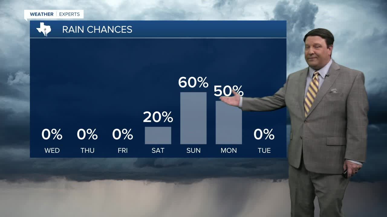
We are tracking a system that will likely impact the region this weekend. In September, sometimes you have to look to the Pacific Ocean for tropical activity. We happen to have Tropical Storm Lorena off the Mexican coast moving northwest. This is forecast to eventually loop over the Baja and into western Mexico. This would send the tropical moisture over Texas Sunday into Monday. We will track this closely since this would have the potential to provide parts of Texas with heavy rain late this weekend. This will also cause highs to come down. Saturday still looks hot with highs in the mid 90s, but we will likely fall into the low to mid 80s if all holds true by Sunday. Stay tuned...
