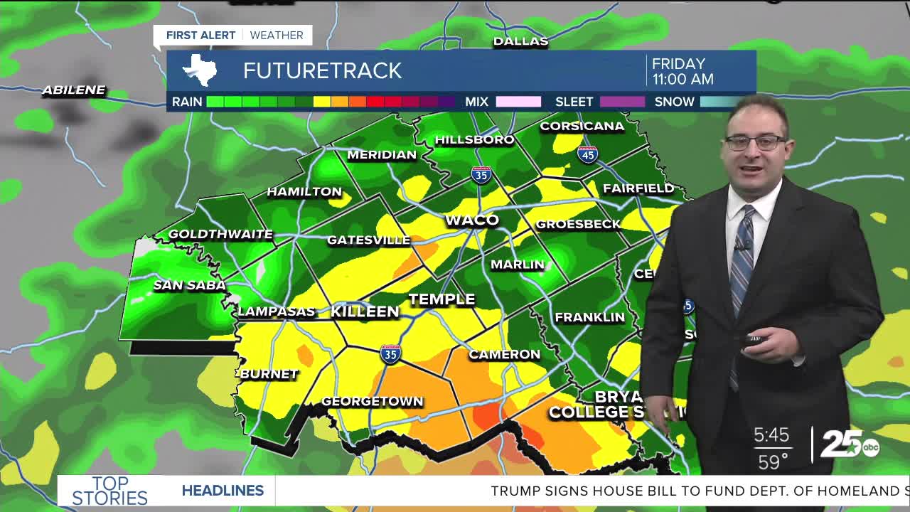


CENTRAL TEXAS — Heavy rain fall for central and southern Texas today. Flood Watches are in effect until 9pm for the southern half of Central Texas. This includes Killeen, Temple, San Saba, Centerville, and College Station. These areas will see around 1-3" of total rain today. Waco / McLennan County is not under the Flood Watch and the forecast rain is closer to just 1" and as such the flood risk is lower overall. So far, the worst of the rain has hugged the I-10 corridor from San Antonio to Houston.
The heaviest rain for most in Central Texas will be this morning, before 12pm. The heavier the rain lasts beyond noon, especially for the Brazos Valley, the more likely flooding is to occur. However, Model indications is for the rain to start thinning or become more scattered into the afternoon and evening, concluding by approximately 10pm tonight.
The weekend is looking beautiful! The rain doesn't overstay its welcome and we're treated to mostly sunny skies both days with temperatures in the low 70s Saturday, mid 70s Sunday. Low humidity and an excellent pair of days to dry out.
We'll heat up fast next week. High temperatures climb to the upper 80s by Tuesday. Beyond that, we'll see the return of some thunderstorm chances as early as Tuesday night and Wednesday morning. Long-range models don't necessarily agree on how intense any storms or cold front could potentially be, so for now I've just kept the thunderstorm forecast fairly generic between Wednesday and the Mother's Day weekend.
- 25 News Meteorologist Thomas Patrick
Want this forecast delivered to your inbox each morning? Sign up for the daily forecast email newsletter here.
