



CENTRAL TEXAS — Is that thunder I hear?? Finally some rain to help alleviate the very dry conditions... even if just a little. With this weak cold front passing through our area today, we will see a wet start to the day, then a chance for rain again in the afternoon. Temperatures will drop a few degrees behind the front and drier air and sunny skies will prevail.
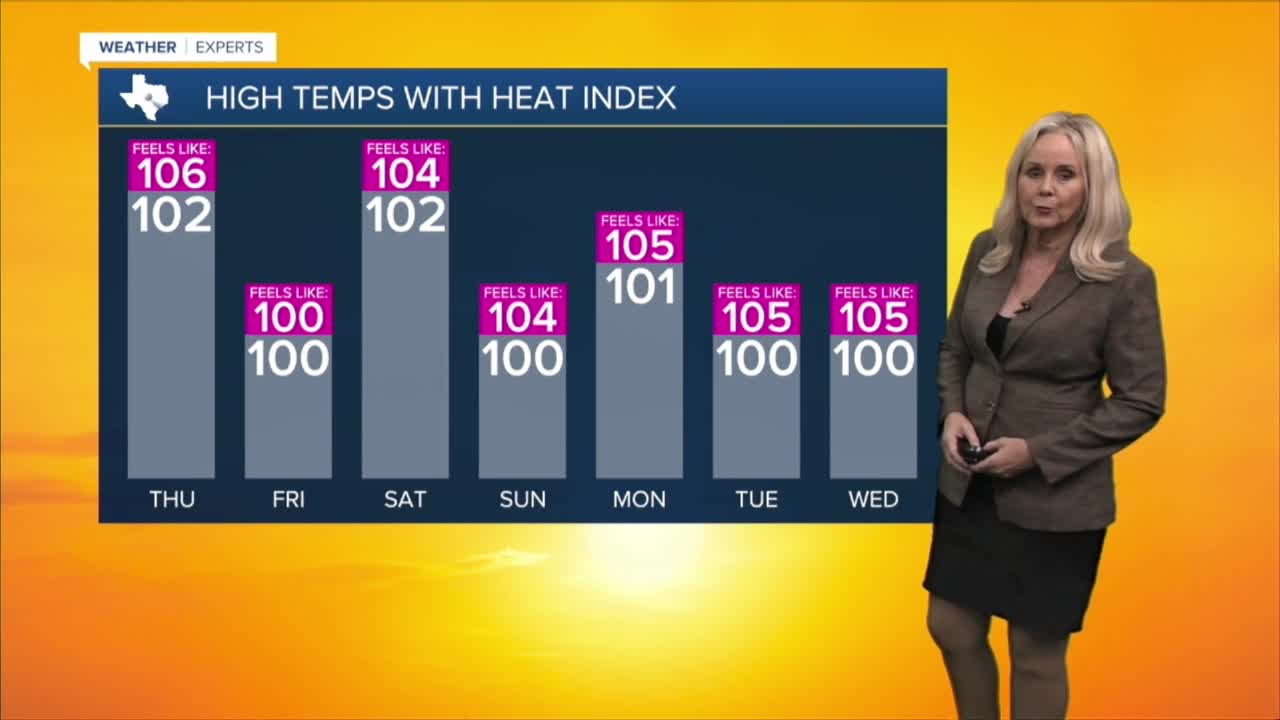
We will still reach about 102 degrees today. The heat advisory has lifted in Mills, Lampasas, San Saba, Burnett and Hamilton Counties but remains everywhere else in Central Texas. The Brazos Valley is also no longer under the heat advisory. For counties under the advisory, you can expect feels like temperatures to fluctuate between 102 up to 109 degrees in the afternoon.
For the next ten days, expect temperatures to lower but humidity to stay moderate. High temperatures will linger around 100 degrees with feels like temperatures about three to five degrees higher starting Saturday.
The fire threat level has mostly been downgraded to moderate for Central Texas and the Brazos Valley. However, burn bans remain throughout Central Texas and Grimes County.
Meanwhile, in the tropics, a disturbance off the coast of Africa is back to having a 70% chance of developing into a tropical system.
Want this forecast delivered to your inbox each morning? Sign up for the daily forecast email newsletter here.
