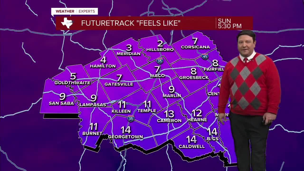


25 EVENING WEATHER — Most of the precipitation from our winter event is over, but there could be a few flurries through the evening hours. Roads remain icy, and that won't change tonight. Travel is not advised. Lows will be cold in the low to mid teens with wind chills in the single digits to near zero by morning. Monday will bring a lot more sunshine to the area. This should help to melt the ice, but highs will only be in the lower 30s. That means a lot of the ice may stick around, and we will get refreeze Monday night into Tuesday morning. Lows will once again make it into the teens Tuesday morning.
Large improvements will come Tuesday as our arctic air mass starts to lose hold of the region. It will be mostly sunny with highs in the low 40s. Mid 40s return Wednesday, and we should be back in the low 50s Thursday. That means it's back to normal around here starting Tuesday afternoon!
The models have changed a bit for late next week and next weekend. Some runs were showing the possibility of another winter event, but that is starting to become less likely at this point. It still looks chilly Friday with a few showers and highs in the mid 40s. More 40s are likely next Saturday under partly cloudy skies.
Want this forecast delivered to your inbox each morning? Sign up for the daily forecast email newsletter here.
