

CENTRAL TEXAS — We inch closer towards a tricky forecast that calls for thunderstorms and a low-end severe weather chance for Central Texas on Sunday.
Today, more of the high humidty pop-up showers continue this afternoon. This will die off after sunset, everything non-severe. Meanwhile, strong thunderstorms are developing in far southwest Texas, near El Paso and Midland. These storms will develop into a complex that will traverse through west Texas into our region into early Sunday morning. The timing should put those storms around San Saba at 4am, Waco around 8am, and I-45 around 11am. These storms will be sub-severe. Gusty winds up to 50mph with heavy rain of about ½ to 1".
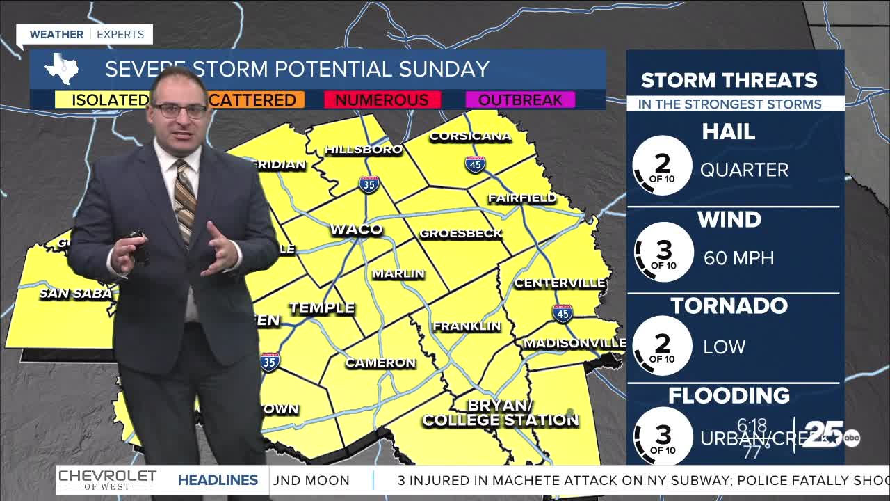
Into Sunday afternoon we have what can be most accurately described as a conditional severe weather chance. "Conditional" meaning that in order to realize any severe weather, the atmosphere must recover after the morning batch of storms with sunshine. The issue is that models have generally not produced any sunshine or energy recovery for Central Texas which will quell any strong thunderstorms from developing in the first place. But the models that do fire up those storms is enough to account for it in the forecast. Be aware of an isolated severe thunderstorm later Sunday afternoon. Main threat would be high winds up to 60mph. Hail or a tornado cannot be ruled out. Any severe weather (that manages to develops in the first place) would be over by 10pm at the latest.
Isolated thunderstorm chances continue for the first half of next week, but nothing jumps out of the page as a significant chance. So probably a lot of humidity driven storms from Monday to Wednesday. High temperatures inch into the low to mid 80s all of this week.
- 25 News Meteorologist Thomas Patrick
Want this forecast delivered to your inbox each morning? Sign up for the daily forecast email newsletter here.
