

CENTRAL TEXAS — Highs will climb into the low 70s this afternoon despite a cold front moving through. Expect plenty of sunshine with colder air by morning.
THE BREAKDOWN:
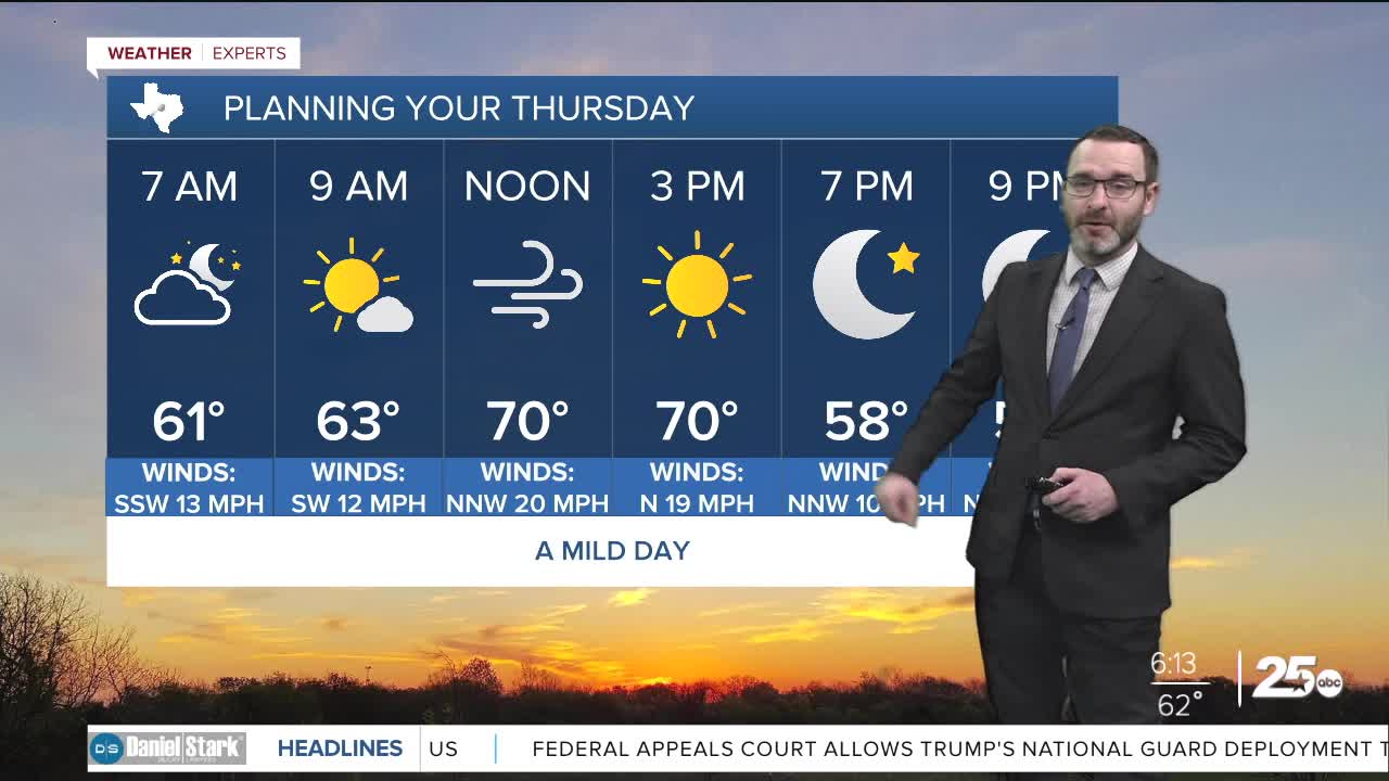
- Damp and drizzly at times early in the morning.
- Cold front arrives later in the morning.
- Drier and sunny this afternoon with highs in the 60s and 70s.
- Cold overnight in the 30s.
- Warming trend into the weekend.
Good morning! Some of us are waking up to a drizzly morning with lots of moisture in place. That should be changing later this morning as a cold front comes in. Don't expect a lot of cooler air with it at least initially. We'll see highs still climb close to 70 this afternoon with gusty winds around 15-25mph. Once the winds relax tonight, that's when the drier air will allow for a chill to develop. Lows should fall into the 30s by morning, with some areas potentially nearing freezing. While I think most of us avoid a freeze, bring in the pets and the plants just to be safe.
South winds will pick back up tomorrow, but with cooler air, we will likely be in the mid 60s. South and southwest winds work overtime on Saturday pushing highs into the upper 70s. It's looking like another front will try to wiggle in Sunday, but will likely stall out. This could lead to a cloudier and cooler day Sunday. That's the last chance of cooler air before an upper-level high brings near record heat for the Holiday week. Highs will likely near 80!
Have a great Thursday!
Meteorologist Josh Johns
25 Weather
Want this forecast delivered to your inbox each morning? Sign up for the daily forecast email newsletter here.
