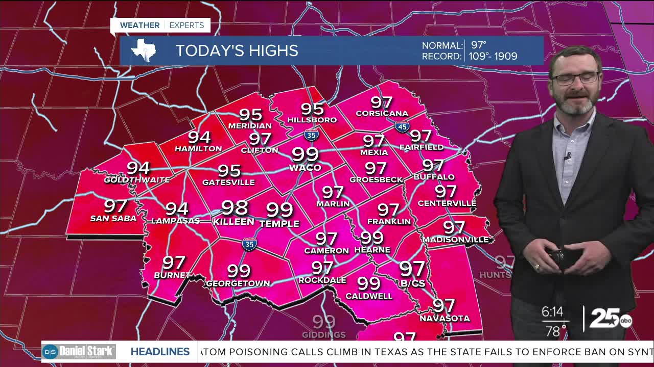


CENTRAL TEXAS — Highs will climb into the upper 90s with feel-like numbers exceeding 105 in spots. A few showers will be possible during the peak heating of the afternoon
THE BREAKDOWN:
- Dangerous heat possible again today.
- Small rain chances the next couple of days.
- Weak cold front brings better rain chances mid-week.
Good morning! We're setting up for another hot one today as highs are expected to climb into the upper 90s with feel-like numbers exceeding 105 in some spots. Continue to take your heat precuations: plenty of water, frequent breaks in the shade if you're out working in the heat of the day, and if not, limit your time in the heat of the day. Some of you may get some natural A.C. during the afternoon thanks to a pop up shower. The best chances will be east of I-35.
As high pressure shifts west through the end of the week, we'll actually see a few disturbances move over bringing better rain chances. Coverage increases into Wednesday and Thursday as a weak cold front moves through. Highs will still reach the mid to upper 90s Wednesday but we'll drop into the low to mid 90s for the second half of the week into the early weekend. With a weaker high, we'll only return to the mid 90s for next week, with another cold front possibly on the horizon for the middle of the week.
Have a great Monday!
Meteorologist Josh Johns
25 Weather
