



ENTER DATELINE — The holiday weekend is shaping up to be quite nice for outdoor adventures. If you like a cooler vibe, I'll suggest planning an early-morning outing, as temperatures will be in the 60s and 70s.
By the time lunchtime hits, we will reach the 80s. Then by the afternoon we head to the low 90s. What makes this weekend such a lovely 3-day holiday is that rain chances stay at bay and humidity remains low. Plenty of sunshine.
Rain chances return to the forecast at the end of next week as a cold front arrives in Central Texas. This should bring us some rain next Friday to Saturday, with cooler temperatures showing up.
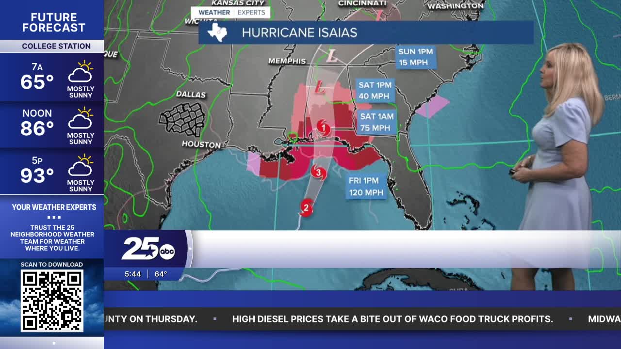
Hurricane Isaias has strengthened to a Category 2 hurricane and is expected to grow to a major category three hurricane. Late Friday night into Saturday morning, it's expected to make landfall along the Florida Panhandle as a dangerous hurricane.
It will bring life-threatening storm surge, strong winds, and flooding to the northeast coastline. As it moves north-northeast, the Florida Panhandle and most of Alabama will receive the brunt of rain and strong winds as it continues to move up through Alabama.
Portions of east Mississippi and west Georgia will also feel an uptick in wind and rain. Isaias will not affect Central Texas.
Want this forecast delivered to your inbox each morning? Sign up for the daily forecast email newsletter here.
