

CENTRAL TEXAS — A storm system will bring a chance for showers and storms through Wednesday.
This afternoon, there is a conditional threat for isolated severe storms. We have quite a few showers out there, preventing daytime heating. This may allow the cap to hold into the afternoon hours. If the cap can break in a couple of locations, then isolated supercells would be possible with all severe weather hazards possible. As of now, there is a low chance that this will happen.
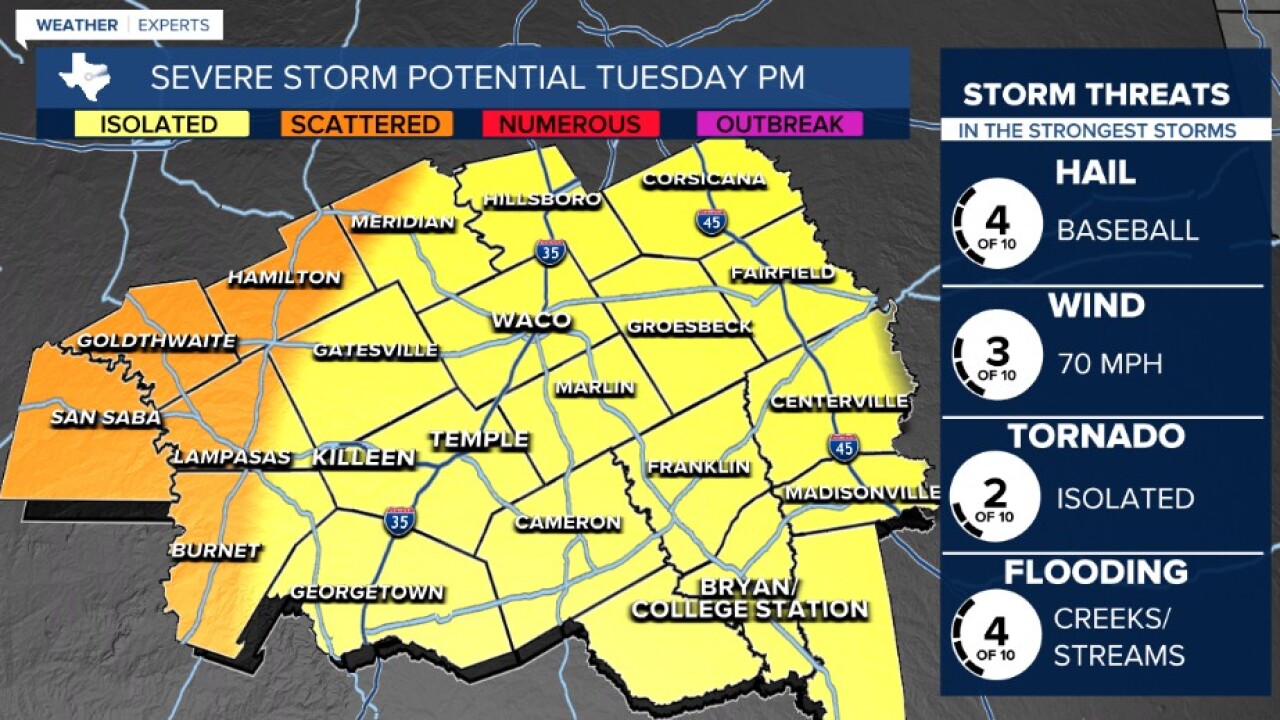
Widespread storms will develop in west central Texas this afternoon and evening as our storm system moves into Texas. These storms will be severe as they develop to the west of our area. A line of storms will likely develop and push into our western counties by mid to late evening. Large hail, strong winds, and an isolated tornado are all possible, especially along and west of highway 281...west of a Lampasas to Burnet line. As storms move east, they will weaken as energy levels fall and the cap strengthens closer to I-35. This will allow more of a locally heavy rain threat to take over for the rest of the night into the morning hours Wednesday. Off and on showers and storms will be possible through the day Wednesday as well, but the severe threat should be lower.
