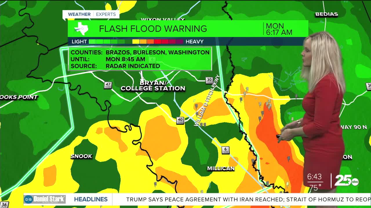


CENTRAL TEXAS — A cold front is making its way through Central Texas, bringing with it a significant amount of flooding. The entire Central Texas area along with the Brazos Valley is under a flood watch through Monday evening. Flash flood warnings are in effect for Brazos and Burleson county through 8:45 a.m. Portions of Williamson and Burnet counties are under a flash flood warning through 7 a.m.
So far Waco has received over four inches of rain. In the Brazos Valley, initial reports from the Dopplar Radar have Caldwell receiving 10 inches of rain with Bryan and College station at three inches. At one point southbound I-35 was shut down between Waco and Hewitt due to flooding. As the day begins we will see just how the flooding in the Brazos Valley has affected the landscape.
The good news is the northern half of Central Texas is beginning to dry out. Temperatures will land in the low 80s today. A few lingering showers remain possible but mostly it will be cloudy and cooler, with decreasing clouds as the day progresses. The Brazos Valley will should begin to dry out by 8 a.m. with a small chance for a lingering shower today and greater chances Tuesday evening.
Temperatures rebound to the 90s beginning Wednesday.
