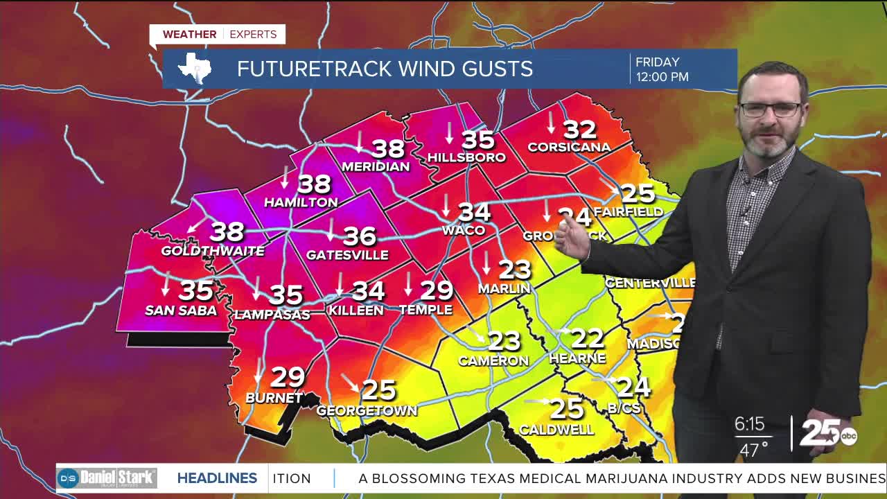


CENTRAL TEXAS — Winds may gust around 30-40mph with the arrival of a cold front today. Expect a chilly weekend with the potential for a hard freeze overnight Saturday into Sunday.
THE BREAKDOWN:
- Cold front arrives by the middle of the day.
- Wind gusts 30-40mph possible.
- Falling temperatures tonight.
- Chilly weekend on tap with hard freeze potential overnight Saturday into Sunday.
Good morning! We're waking up to a morning with temperatures in the 40s to start the day. Another cold front is on the way today that will bring gusty winds again today with the potential for winds to gust as high as 30-40mph by the middle of the day. Highs will climb into the 60s ahead of that front with falling temperatures tonight. By morning, we could see temperatures in the 30s with feel-like numbers in the 20s. Saturday, we will struggle to see highs get out of the upper 40s thanks to the cold air. Overnight into Sunday morning will bring the coldest temperatures, with low to mid 20s possible for lows. That will be a hard freeze, so you will need to bring in the pets and the plants and wrap outdoor pipes and faucets. South winds will thaw us a bit Sunday as we climb into the upper 50s.
Next week looks to be a complicated forecast, but some rain chances may move in by Tuesday into Wednesday, though the heaviest rain will fall south of us near the coast. Stay tuned!
Have a great Friday!
Meteorologist Josh Johns
25 Weather
Want this forecast delivered to your inbox each morning? Sign up for the daily forecast email newsletter here.
