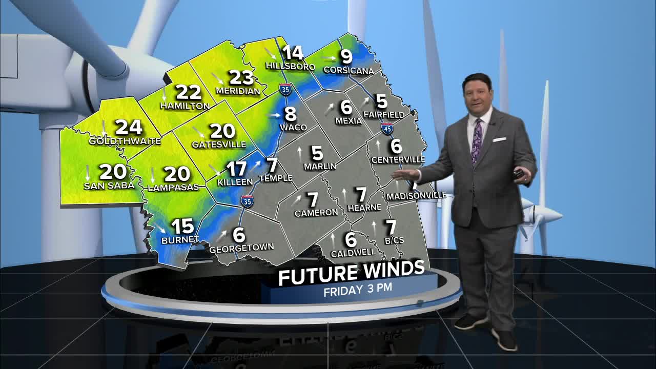


25 EVENING WEATHER — After seeing some very warm days, a cold front will change things Friday afternoon. Tonight will be partly to mostly cloudy with lows in the mid 60s. Friday, we should see partly to mostly cloudy skies throughout the day. Our cold front will arrive by mid-afternoon for Waco/Temple/Killeen. Highs will likely get to around 80°, then fall behind the front. Once the front passes, winds will shift out of the north at 20-30mph with higher gusts. Temperatures will fall into the 60s by sunset and the low to mid 50s Saturday morning. There could be a few sprinkles or very light showers Friday night into Saturday morning. The chance of measurable rain as of now is less than 20%.
Saturday now looks mostly cloudy and cooler. Highs will be in the 60s for many areas, but we may see some low 70s across our southern areas. Winds will be out of the northeast at 10-20mph. This front will stick around long because highs by Sunday afternoon will be back in the low 80s.
Next week's forecast is as clear as mud. The first part of the week looks warm with highs in the mid to upper 80s. We should see at least some slight rain chances by the end of next week into Easter Weekend. Placement of any eventual storm system remains volatile, so we will keep rain chances and amounts low as of now. It will likely cool off again Easter Weekend, so stay tuned!
Want this forecast delivered to your inbox each morning? Sign up for the daily forecast email newsletter here.
