

CENTRAL TEXAS — A mild clear morning will turn to a gusty afternoon with the arrival of a cold front. Central Texans woke up to temperatures in the 60s. After a stretch of very warm afternoons, today will cool down along the I-35 corridor and west of I-35 as high temperatures peak around 80 degrees.
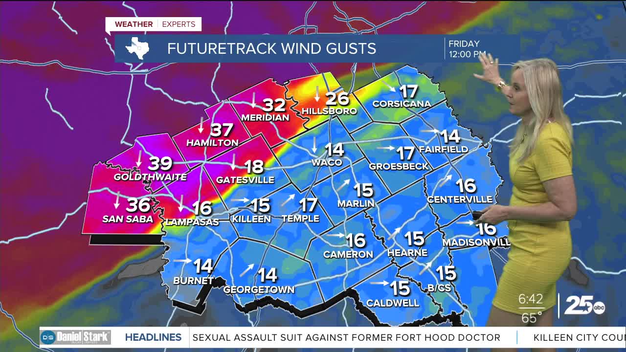
The sunshine that arrives by lunchtime will fade to cloudy conditions as the front passes through in the early afternoon. Winds will be the main issue with sustained speeds between 15 and 25 mph. Gusts could reach up to 40 mph. Once the evening arrives, the winds will begin to subside.
Wee could see a few sprinkles and light showers mostly for the northwest portion of Central Texas overnight. However, this front is really a wind, cloud and temperature event.
Temperatures will dip into the 50s Saturday morning. The afternoon high will reach the 60s. After that, a cool Sunday morning will be the extent of this front. By Sunday afternoon we are back in the low 80s. The beginning of the work week remains quiet with warm temperatures in the 80s and dry skies. Rain chances return on later in the week but how much we will receive is yet to be determined.
Want this forecast delivered to your inbox each morning? Sign up for the daily forecast email newsletter here.
