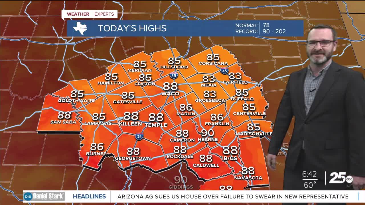


CENTRAL TEXAS — Highs will climb into the upper 80s this afternoon with more clouds building over Central Texas. Rain chances start Friday with the peak being overnight.
THE BREAKDOWN:
- Clouds increase Thursday as temperatures climb into the upper 80s.
- Showers and storms possible in the afternoon Friday.
- Storms likely Friday Night into Saturday morning.
- Total rainfall amounts up to 2 inches with some locally heavier amounts.
Good morning! We're waking up to a cool morning with lows in the low 60s. Clouds will be on the increase Thursday with south winds bringing up more moisture. Highs will make it into the upper 80s this afternoon. Overnight, don't expect numbers to be as cool as we will wake up to temperatures near 70 thanks to the moisture that will have worked in.
Our weekend rain chance begins Friday where we may have some scattered showers or isolated storms lifting across the area through the day. The best chances for rain will hold off until Friday night, when we do expect a complex of showers and storms to work into the area from the west. Models have sped up this activity overnight to where we could now see the strongest storms working in as early as 9pm and lasting through the overnight hours. If we get a line of storms to build, there will be the potential for some pockets to turn severe with gusty winds. The highest threat of that will be found west of I-35. By and large the biggest impacts from these storms will be heavy rain, as much of our area will see widespread totals of 1-2 inches. Some areas could pick up as much as 4-5 inches of rain in isolated spots. This could bring a threat of flash flooding that we will need to monitor.
While activity is expected to decrease during the day Saturday, we could still see lingering rain or new development of showers and storms during the day. This will keep temperatures in the 70s all day Saturday. Behind this system, we'll see highs in the 80s Sunday and warming to the mid 80s Monday before our next cold front arrives sometime Tuesday. That front will bring a more fall-like feel with highs in the low to mid 70s leading into Halloween.
Have a great Thursday!
Meteorologist Josh Johns
25 Weather
