

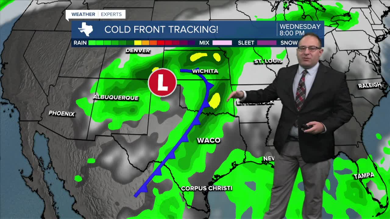


CENTRAL TEXAS — I am thrilled to report that Central Texas will see fairly significant - summer ending - weather changes next week in the from of not one but two cold fronts!
Before we get to the juicy bits of the forecast, Sunday afternoon will have a few isolated summer pop-up thunderstorms. This will mainly be in our western and northwestern counties between San Saba and Hillsboro. High temperatures still in the mid-90s.
The set up for next week: A large trough in the jet stream across the Pacific Northwest will dig into the west coast and cross the Rocky Mountains. It's strong and deep enough that it should extend plenty far south, clear through Central Texas. Additionally, Hurricane Polo in the Pacific will make it's northerly trek across the mountains of Mexico and into New Mexico and west Texas. While the hurricane itself will break apart fully, it'll add some extra moisture as it links up with the forming cold front around Wednesday, September 30.
The cold front will pass through Central Texas between Wednesday, Thursday, and Friday. The exact speed is unclear, but the consistency of the cold front itself being depicted is of high confidence. Just the more precise details are yet to be determined... like how much rain, how much cooler, and how windy some thunderstorms could get. Most model simulations have the heaviest rainfall largely west of I-35.
Temperatures will drop into the upper-80s and mid-80s by Thursday and Friday. About time! That would be the coolest day since June 19th in Waco.
Beyond that, another cold front dives extremely far south with very cool Autumn northerly winds surging cooler air into Central Texas around October 4-5... I would not be surprised to have high temperatures in the 70s around that time! That's music to my ears and hopefully yours!
- 25 News Meteorologist Thomas Patrick
Want this forecast delivered to your inbox each morning? Sign up for the daily forecast email newsletter here.
