

25 WEATHER — A cold front really had an impact on temperatures today! Highs were before sunrise in the 70s, but most of the day was spent in the 50s and 60s. It remain mostly cloudy tonight with lows in the low to mid 50s. Thursday, mostly cloudy skies and below normal temperatures can be expected once again. Highs will occur in the afternoon as we shoot up into the mid 70s. There could be a few isolated showers and storms Thursday afternoon, but rain chances are only 20%.
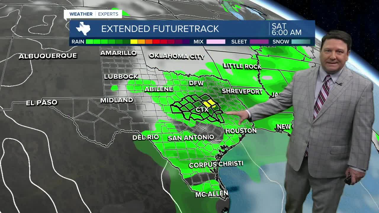
Friday, the mid 80s return for highs under mostly to partly cloudy skies. We may see a few showers in the morning, but better rain chances may occur Friday evening into early Saturday morning. Most of Saturday should be quiet as that system moves east with highs in the mid 80s once again. Mother's Day Sunday will bring a cold front, but that will likely not happen until Sunday afternoon and evening. It will still be warm, with highs in the mid 80s Sunday afternoon ahead of the front. Once the front moves through, temperatures will fall into the 60s and 70s with a chance of scattered showers and a few thunderstorms. We will keep a close eye on any timing changes as we get closer to Sunday.
Want this forecast delivered to your inbox each morning? Sign up for the daily forecast email newsletter here.
