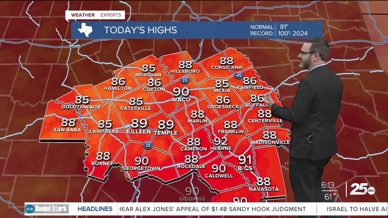


CENTRAL TEXAS — Highs will climb into the low 90s this afternoon with sunny skies. Mornings will remain cool, but rain chances will return this weekend thanks to a weak cold front.
THE BREAKDOWN:
- Highs will climb into the low 90s again.
- Humidity slowly increases for the second half of the week.
- Cold front brings small weekend storm chance.
Good morning! We're waking up to morning lows in the upper 50s and low 60s thanks to clear skies. Once again, with dry air in place, we will see highs get closer to 90 in the afternoon. Winds will be light out of the east, reinforcing the drier air.
Humidity will be increasing for the second half of the week as winds turn to the south. This will bring up morning lows, but afternoon highs will stay closer to 90. Eventually a storm system currently over the Sierra Nevada will send a weak cold front our way this weekend. This won't bring a huge cool-down but will bring us the potential for some storms on Saturday. I don't expect anything widespread, or severe, as those chances will miss us to the northeast, but we will at least have enough lift for isolated to scattered storms. This front mainly just reinforces drier air, so other than a slight cool-down into the mid 80s Sunday, we will see morning lows come down again. High pressure moves back in for the first half of next week, but there are signs we could get another front next week. Right now, models are all over the place, so I have left warmer temperatures in place for the second half of next week, but there's a potential we could be cooler.
Have a great Wednesday!
Meteorologist Josh Johns
25 Weather
