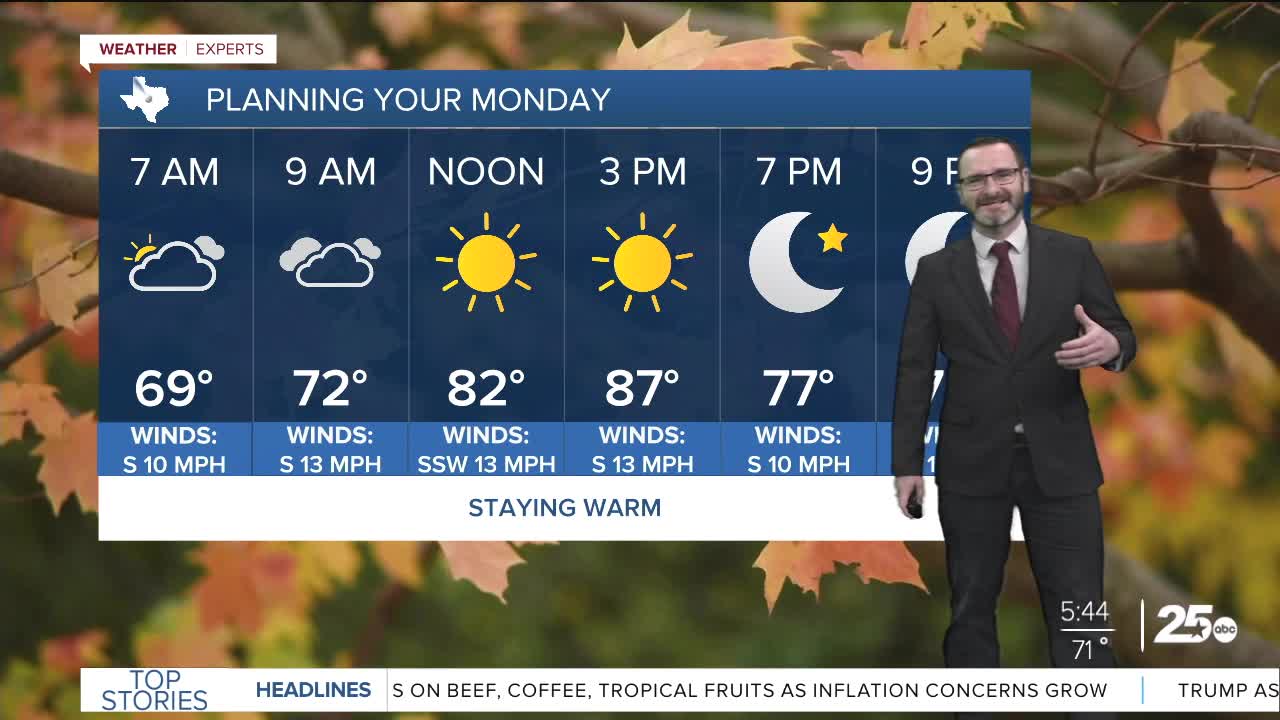


CENTRAL TEXAS — Highs will climb into the upper 80s this afternoon with morning clouds giving way to afternoon sun. Rain chances increase for the middle of the week.
THE BREAKDOWN:
- Near-record heat on the way today with highs in the mid 80s.
- Staying warm Tuesday as well.
- Storm chances increase Wednesday into Thursday.
- Potential for multi-inch rainfall and some strong storms.
Good morning! We're waking up to another warm and muggy morning with lows in the 70s, expect south winds to hang around today pushing highs into the mid to upper 80s. Clouds will be around in the morning, but will break up in the afternoon allowing for plenty of sunshine. Expect more of the same overnight as lows fall down into the 60s and 70s with more clouds. Tuesday will feel very similar with highs once again climbing into the mid 80s.
Big changes arrive for the middle of the week as a strong upper-level low pressure system moves in from California into northern Mexico. Once that turns northeast and heads towards the Lone Star State, we'll see showers and storms break out as early as Wednesday. Widespread showers and storms are expected Thursday with some on the strong side. Rain chances hanging around will keep temperatures in the 70s, and total rain amounts will range from 1-3 inches. We'll have to monitor for flood potential in some spots. On the back side of that, we'll see highs dip into the 60s and 70s. Another storm system may work in for early next week bringing more storm chances.
Have a great Monday!
Meteorologist Josh Johns
25 Weather
