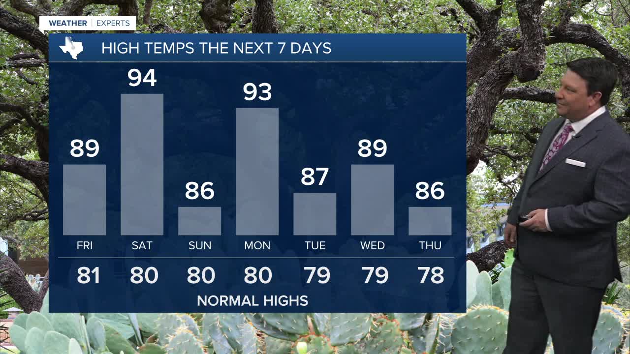


25 EVENING WEATHER — Temperatures will be up and down through early next week as warmer and cooler air battle it out in Texas. Tonight looks mild with lows in the mid 60s. It will be partly cloudy Friday with most areas remaining dry. With that said, an isolated shower or storm appears to be possible in the Brazos Valley Friday afternoon. Otherwise it will be very warm with highs in the upper 80s to near 90°.
If current projections hold true, Saturday could be a hot one with drier air and southwest winds arriving in the afternoon. Highs will be in the low to mid 90s across the area. If the dryline gets farther east than forecast, then I cannot rule out mid to upper 90s, especially out west. There could be a few isolated showers and storms around, but the best chance will likely be north and east of our area Saturday into Saturday night. Sunday should be noticeably cooler with highs in the mid to upper 80s.
Another big warm up is expected Monday with highs in the low to mid 90s once again. Another front should bring us back down in the mid to upper 80s Tuesday. We warm back up close to 90° Wednesday, then it is back to the mid 80s Thursday and Friday. There could be an isolated storm threat by the middle of next week, but chances right now are only 20%.
