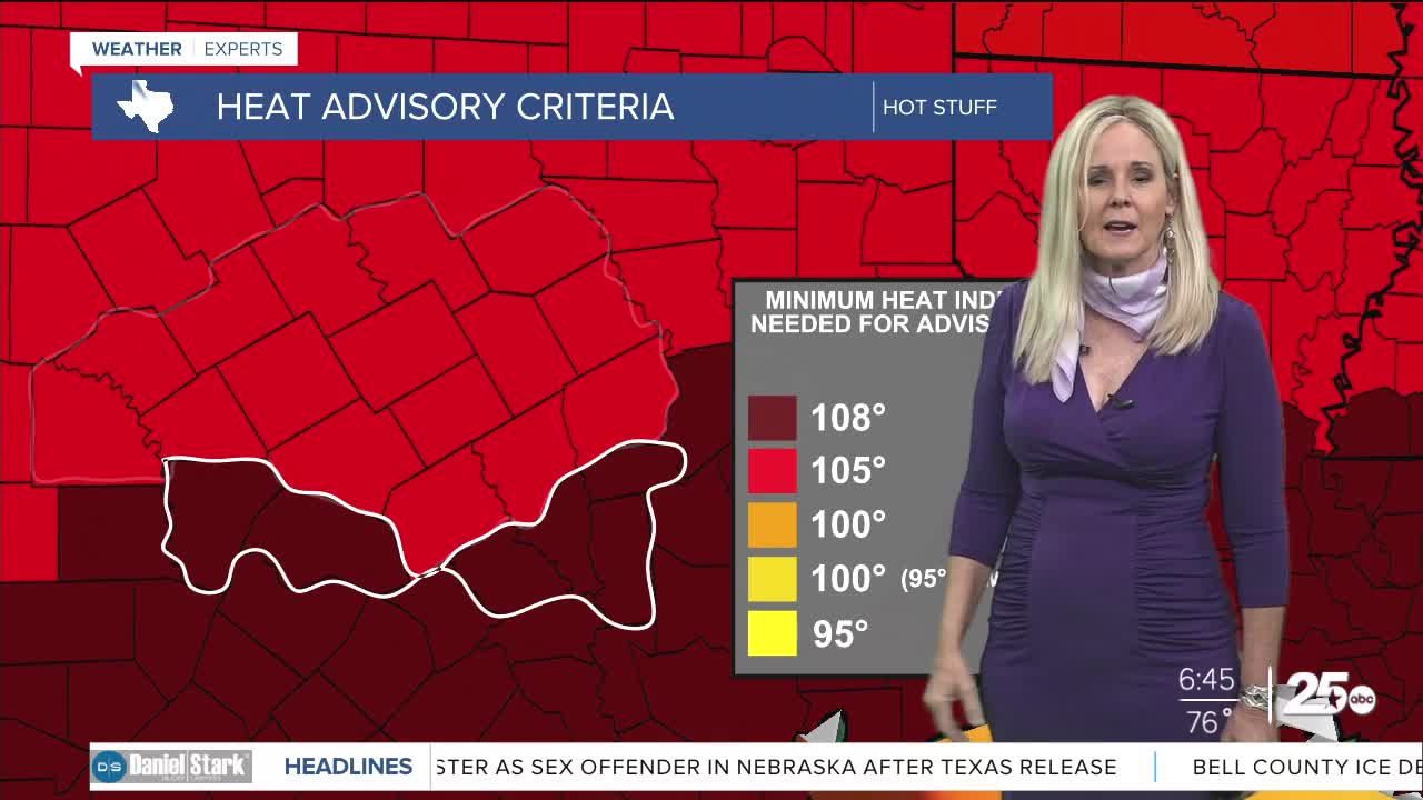


CENTRAL TEXAS — High pressure and moisture from the gulf has set up a brutal work week outside. We reached 93° on Monday, and Tuesday's high should reach 94. If the air temperature has you sweating, just wait for the heat index. With dew points well into the 70s we are expecting the feels-like temperatures to hit the low to upper 100s through Saturday.
Rain chances have all but disappeared this week for Central Texas. We can't rule out a pop-up storm in the Brazos Valley today and tomorrow. But Central Texas counties should remain dry today. I've slated a 20% chance of some quick, light showers on Wednesday, mostly for the southeast areas. The majority of Central Texas will remain dry all week.
High temperatures will remain near the mid 90s with humidity at oppressive levels through Saturday. Those working outdoors should drink plenty of water and limit activity in the afternoon if possible. It's also worth reminding Central Texans to avoid leaving children or pets in a vehicle when going inside, even if just for a few minutes. At 95 degrees, a car can reach a temperature of 114° within 10 minutes. The vehicle can become a death trap very quickly in this heat.
High pressure begins to move out Saturday, which will make space for a cold front to arrive. That will bring down temperatures slightly on Sunday, and give us relief with a bit of rain cooled air. At this point I have Sunday marked with a 30% chance and Monday increasing to a 40% chance of scattered showers.
Want this forecast delivered to your inbox each morning? Sign up for the daily forecast email newsletter here.
