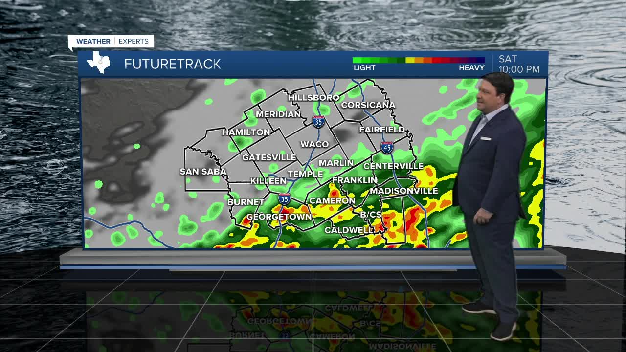


25 EVENING WEATHER — We should be pretty quiet tonight, but we may see one or two storms approach our far western counties late tonight into early Saturday morning. If this occurs, a strong storm can't be ruled out with hail and gusty winds the main threats. The bigger story will be a cold front barreling into Central Texas Saturday morning. The front should be close to Waco/Temple/Killeen between 6 and 8am. A few showers and isolated storms will be possible along and behind the front. Temperatures ahead of the front will be around 70°, but we should quickly fall back into the upper 50s and low 60s once the front passes. These temperatures will likely stick around for the rest of the day. A disturbance will pass over our area Saturday afternoon and evening. This will allow for more widespread showers and thunderstorms to develop. Right now, it looks like there could be enough energy for some of the stronger storms to produce pocket change size hail. This should be the exception rather than the norm, but it is something to keep an eye on Saturday.
We should clear out Saturday night into Sunday morning. Temperatures are expected to fall into the 40s Sunday morning. The sun will return through the day Sunday, so highs are looking warmer in the low to mid 70s.
Our next disturbance arrives early next week (Monday and Tuesday). The models vary with how much cloud cover and rain may occur with this system. Right now, we will go with a 50% chance of showers both Saturday and Sunday. I have highs in the upper 60s Monday and Tuesday as of now, but this may change based on how much rain and cloud cover is across the area each day.
Have a great weekend and stay dry and warm!
Want this forecast delivered to your inbox each morning? Sign up for the daily forecast email newsletter here.
