

CENTRAL TEXAS — Low cloud cover and light fog is developing in our northwestern and western counties this Thursday morning. It should dissipate by 7am. As we move into the afternoon the mostly cloudy skies will become partly cloudy.
Another very warm and humid afternoon is on tap for central Texans today. Our high temperature will should land at 88 degrees. That would be a degree less than Wednesday's high of 89. Despite a minute drop in the air temperature, the dew points will remain in the low 70s, making the feels like temperatures remain in the 90s.
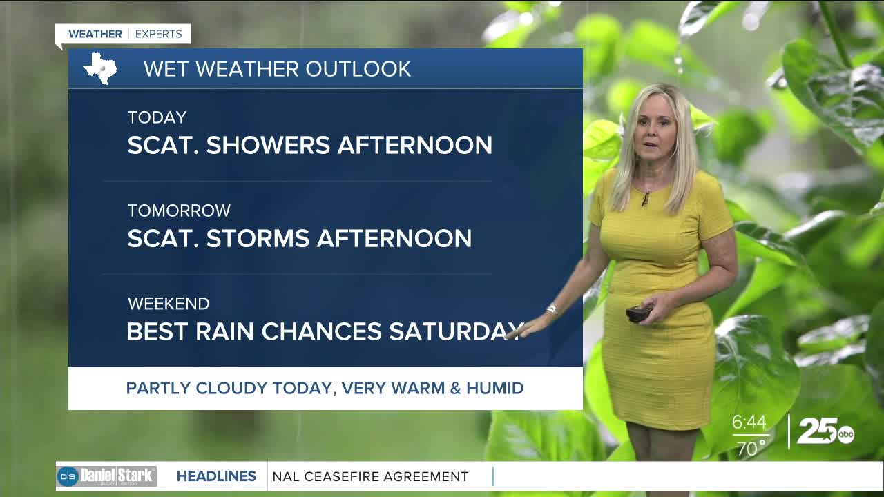
Rain chances will be sporadic today with scattered showers possible this morning and better chances in the afternoon for Central Texas and the Brazos Valley. Last night the Brazos Valley picked up between one and two inches of rain from isolated storms.
Thursday and Friday the rain chances hold at 30%. Saturday gives us the beast chance for rain at 50%. Temperatures remain in the upper 80s with plenty of humidity into to the weekend.
On Sunday rain chances drop to 30% but temperatures return to the 90s, and humidity skyrockets. As we begin the workweek, high pressure sets in with high humidity, clearer skies and temperatures holding steady in the low to eventually mid 90s. Next week will be hot and humid!
Want this forecast delivered to your inbox each morning? Sign up for the daily forecast email newsletter here.
