

25 EVENING WEATHER — A storm system will move across Texas on Valentine's Day. This will bring a chance for showers and storms to the area, especially late morning into the early evening hours Saturday.
Tonight looks mostly cloudy with a few isolated showers possible by morning west of I-35. Lows will fall into the low to mid 60s.
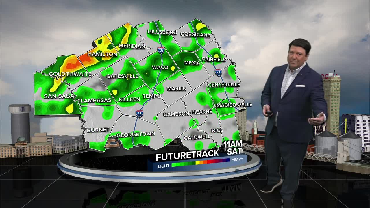
Saturday, scattered showers and storms will start to fill in west of I-35 during the morning hours. Instability values will be rather low, but some gusty winds will be possible with this activity. As storms move east, they will encounter a slightly more favorable environment for strengthening. Areas near I-35, including Waco, Temple, Killeen, should see the area of showers and storms move through from early to mid afternoon. Areas in the Brazos Valley and I-45 will likely see more of the activity by mid to late afternoon into the early evening hours. I think this area will have the best chance for a couple of severe storm with-n the line. Small hail and strong winds will be the main threat. There could be a small window for a spin-up or two in the Brazos Valley early Saturday evening. The higher potential will be in southeast Texas, but it will be something we watch closely. All of the stormy weather should move out before 10pm. Highs Saturday will be in the upper 60s and low 70s with lows by Sunday morning in the low to mid 50s.
Sunday looks nice with breezy northwest winds and highs near 70°. Have a great and safe weekend!
Want this forecast delivered to your inbox each morning? Sign up for the daily forecast email newsletter here.
