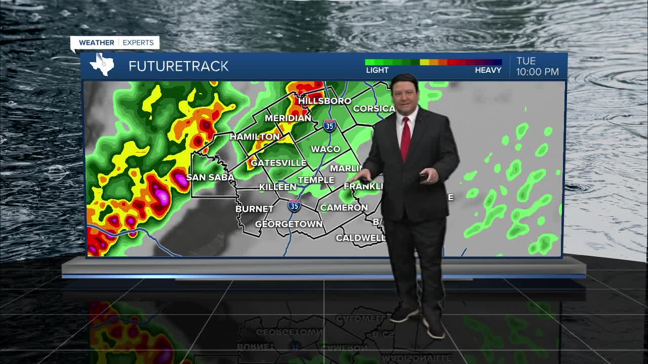


25 EVENING WEATHER — Thunderstorm potential will be going up this evening, especially west of I-35. A few storms could be strong to severe with large hail, strong winds, and an isolated tornado or two. Storms should gradually weaken as they approach I-35 late tonight and continue to push eastward. There will likely still be some rain around for the Wednesday morning commute, so plan accordingly. Lows tonight will fall into the low to mid 60s.
Wednesday will bring another chance of storms, this time mainly along and east of I-35. There could be a few stronger storms with hail and gusty winds, but the severe threat should be lower than Tuesday. Locally heavy rain is possible from time to time.. Highs will be in the mid 70s, but a cold front will bring gusty winds in the afternoon at 15-25mph. Rain chances will end Wednesday night as the front continues to move through the area.
Thursday will start off chilly with lows in the 40s, but we should make it up into the mid 60s Thursday afternoon with plenty of sunshine. Friday looks nice with highs in the mid 70s!
The weekend should be warm around here. Highs Saturday and Sunday will rise into the low to mid 80s. A strong cold front should arrive late Sunday afternoon. This will bring strong north winds and falling temperatures into the lower 40s by Monday morning. We may not get out of the 50s Monday afternoon.
Want this forecast delivered to your inbox each morning? Sign up for the daily forecast email newsletter here.
