

25 EVENING WEATHER — A weak storm system will move across the area tonight into Wednesday morning. Sprinkles or a few showers are possible, but the chance of measurable rain will be 20-30%. Lows will fall into the low 50s in the morning. North winds will dry us out more as we head through the day Wednesday. This will bring decreasing clouds and highs in the low 70s.
Thursday and Friday, temperatures warm up quickly again. Highs will be in the upper 70s Thursday and around 80° Friday afternoon. There could be a slight chance of a shower of storm across our western counties Friday evening, but most of the activity should be north and west of Central Texas.
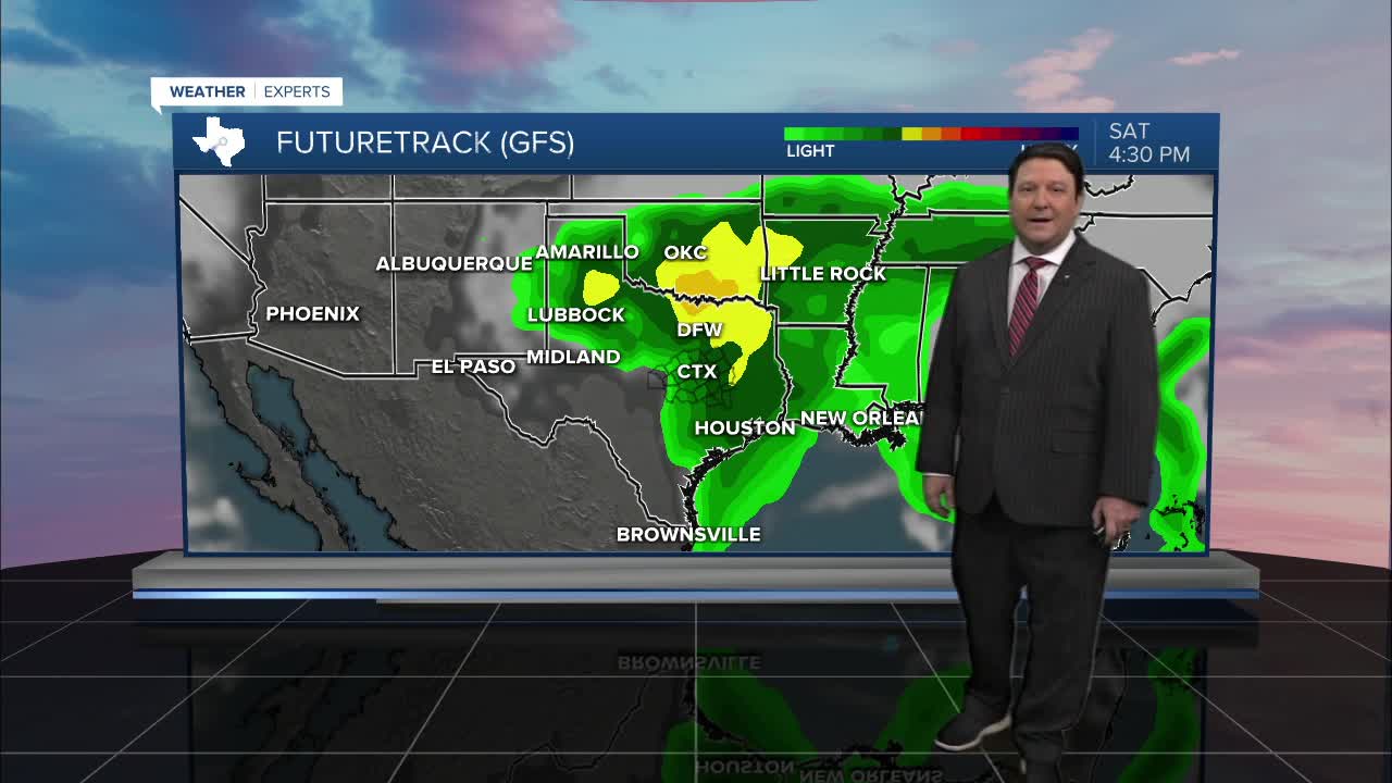
Our next storm system should arrive on Valentine's Day. The track of this system is still not set in stone, so a couple of things could happen here. A more southerly track would bring a good chance of widespread rain through the day Saturday. A farther north track would bring rain, but it would be scattered and come through as a line. This would clear us out faster Saturday afternoon and evening. Right now, I am leaning toward the farther north track, with the heavier rain across north Texas into southern Oklahoma. This will be settled over the next couple of days as more data becomes available. A couple of stronger storms are possible, but the better chance of severe weather would likely be east of our area. Highs will be in the low 70s Saturday afternoon, banking on clearing a bit faster. Sunday looks nice with highs in the upper 60s. There could be a brief shower or two Sunday morning as some wrap around moisture moves through the northern half of Central Texas.
Want this forecast delivered to your inbox each morning? Sign up for the daily forecast email newsletter here.
