

CENTRAL TEXAS — 4pm update: A thunderstorm near Stephenville is the closest to Central Texas currently. Should this storm continue southeastward, it'll be in Hamilton and Bosque Counties around 6pm. We'll monitor if this storm will continue to hold it's strength or quite possible help new storms to form along an outflow boundary that this storm is using as a pathway into our area.
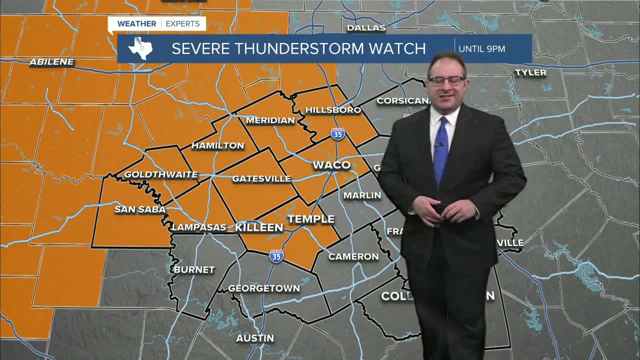
A Severe Thunderstorm Watch has been issued until 9pm for parts of Central Texas. This includes Waco, Killeen, Temple, among other areas north and west of I-35.
Counties included in Central Texas are: McLennan, Bell, Coryell, Hill, Bosque, Hamilton, Lampasas, Mills, and San Saba.
Severe thunderstorms will develop near and north of Abilene this Sunday afternoon and transform into a squall line of thunderstorms along a cold front as it pass into and through Central Texas. The latest approximate timeline will be storms hit northwestern counties around 7pm, Waco/Killeen/Temple around 9pm, and Brazos Valley around 11pm.
High winds upwards of 70mph is the primary threat with these thunderstorms across Central Texas. Some of the first thunderstorms to form may also produce large hail up to tennis ball sized and a brief tornado, especially for areas closer to I-20.
The Facebook post above has even more specific details from this morning's forecast update.
This article will be updated throughout the evening as the strong thunderstorms pass through, so check back for updates.
- 25 Meteorologist Thomas Patrick
Want this forecast delivered to your inbox each morning? Sign up for the daily forecast email newsletter here.
