


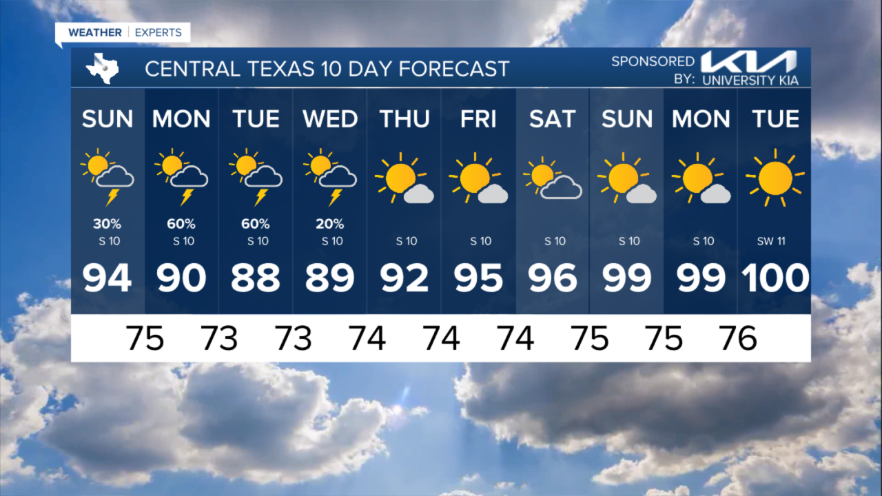
Happy weekend! While chances for rain showers and isolated thunderstorms will be possible this weekend, it will not be a complete washout. Greatest chances for wet weather develop ahead of a front by Monday
Highs for Sunday will rise into the middle 90s with heat index values near 100. Keep an eye to the sky as there will be about a 30% chances for showers and storms.


A cold front dips in from the north and will be the focal point for more widespread rain and thunderstorms for early next week. Monday's rain chances are up to 60-70% and stay there Tuesday as well. Model indications put another ½ to 1" of rain for most of Central Texas, with a few spots that could go much higher due to heavier downpours. That much needed change of pace will push temperatures to the mid- to upper- 80s between Monday and Wednesday.
