
CENTRAL TEXAS (KXXV) — Central Texas is starting 2026 with unseasonably warm temperatures, as high pressure and southwest winds push afternoon highs into the low to mid-70s on New Year's Day.
I'm waking up to chilly temperatures in the low 40s this morning, with some areas even dipping into the upper 30s. However, southwest winds will quickly warm things up as they blow down the terrain, bringing warmer air into the region.
By noon, I expect temperatures to reach the mid-60s, climbing to low to mid-70s this afternoon. Some western areas could even see upper 70s where the wind continues to blow strongest. High clouds will build throughout the day, which may limit how warm we get.
Our normal high temperature for this time of year is around 58 degrees, making today's forecast significantly warmer than average. However, we won't be challenging any records.
Even warmer weather ahead
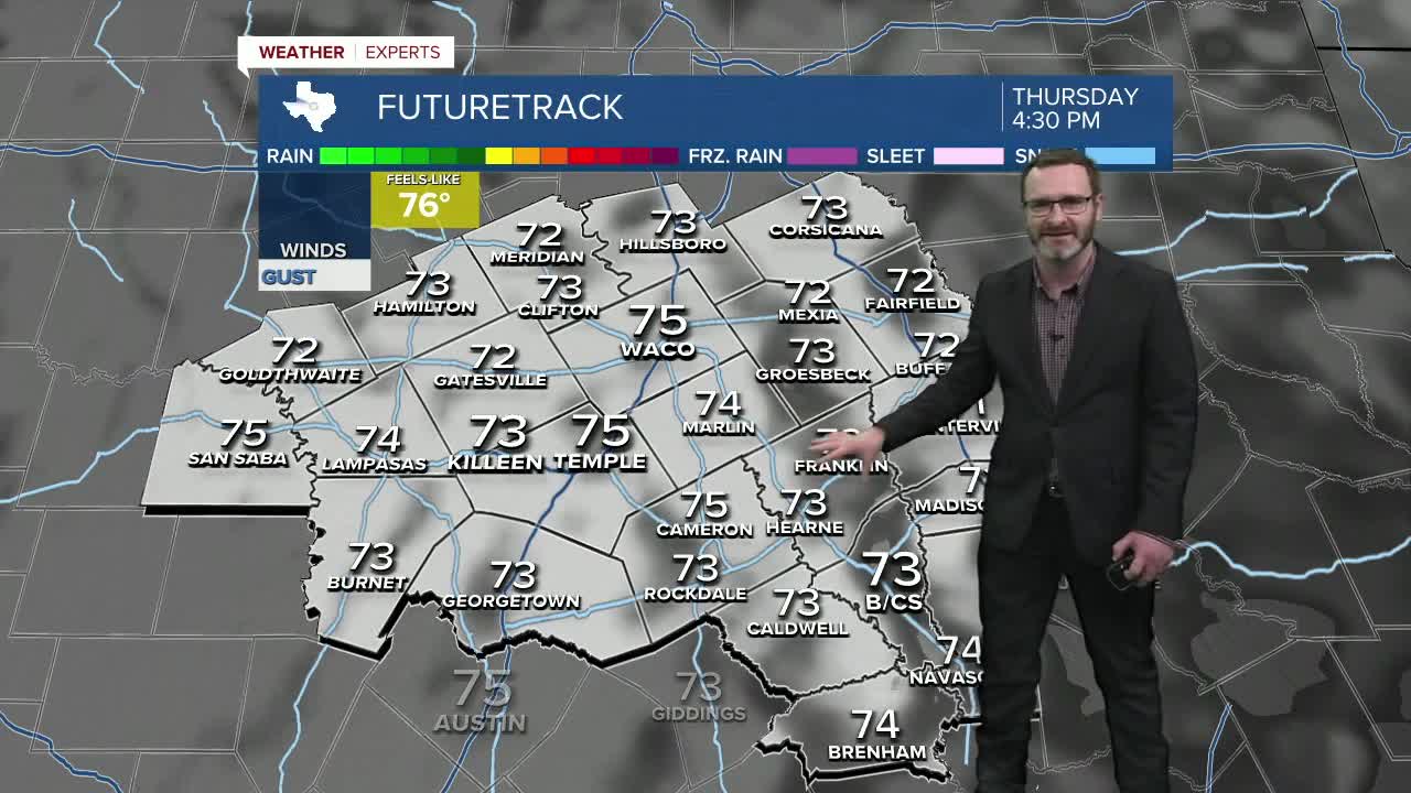
The warm pattern continues Thursday, with southwest winds pushing temperatures into the mid-70s despite high clouds at times. Those clouds will actually help keep us from reaching the 80s.
Friday looks to be the warmest day of the stretch. As winds shift to the west and blow down the terrain, I expect low to mid-80s to develop. While forecast models may be slightly aggressive with the warmup, low 80s are certainly possible.
Brief cooldown this weekend
A cold front will move through Friday night into Saturday, bringing a brief cooldown. This won't be a strong front and won't produce any rain, but it will be enough to drop Saturday's highs back into the 60s with north winds around 10 mph.
The cooler weather will be short-lived. An upper-level ridge moves in after the front passes, bringing temperatures back into the mid-70s by early next week.
Looking ahead
Another dip in the jet stream could arrive by the end of next week, potentially bringing small rain chances and cooler temperatures for the following weekend.
The 10-day forecast shows highs near 80 degrees on Tuesday, with small rain chances possible by Friday and Saturday of next week.
In the Brazos Valley, similar conditions are expected with near-80 degree temperatures Friday, cooling to the 70s over the weekend, then returning to the mid to upper 70s early next week.
Want this forecast delivered to your inbox each morning? Sign up for the daily forecast email newsletter here.
This story was reported on-air by a meteorologist and has been converted to this platform with the assistance of AI. Our editorial team verifies all reporting on all platforms for fairness and accuracy.
