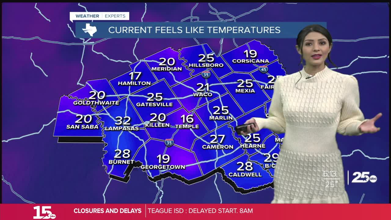


This morning will bring the potential for some freezing fog, along with the refreeze of any ice leftover on roads. Temperatures start off in the middle 20s with a few spots under a cold weather advisory until 9 AM for wind chills in the teens.
By late morning across the area, any foggy conditions should lift. Expect more sunshine with highs for your Wednesday making it above freezing in the middle 40s.
There could be more patchy freezing fog Thursday morning as we drop into the low 30s. South to southwest winds and more sunshine Thursday afternoon will bring highs up into the middle 50s. This will make Thursday the warmest day of the week!
Another cold front is expected to move into the region Friday. Highs will be in the middle to upper 40s Friday afternoon, the mid 30s Saturday afternoon, and the mid 40s again Sunday afternoon. Lows are expected to be in the the teens and 20s through the weekend. Additionally, we stay dry with mostly sunny skies!
